


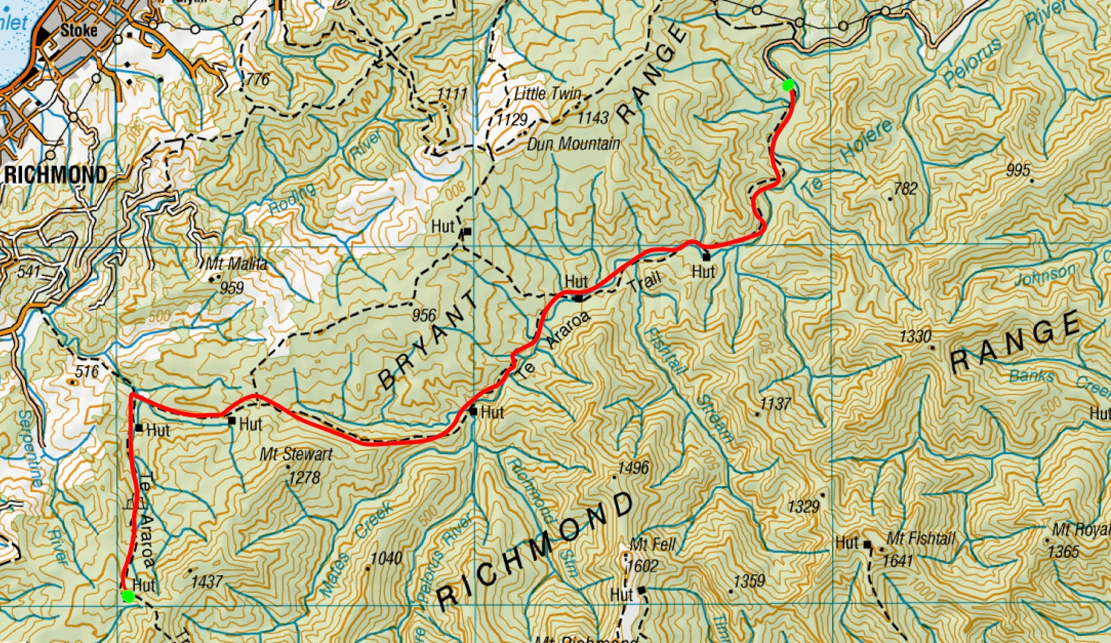
Te Araroa - The Richmond Ranges

Ok we’ve covered some good sections for you fresh faced newbies out there but now it’s time for the big boys. I’m talking; leave the kids at home, break out the blister wool and empty your bags of anything that isn’t food and water cause these sections are not for the faint of heart or anyone cautious of their fitness.
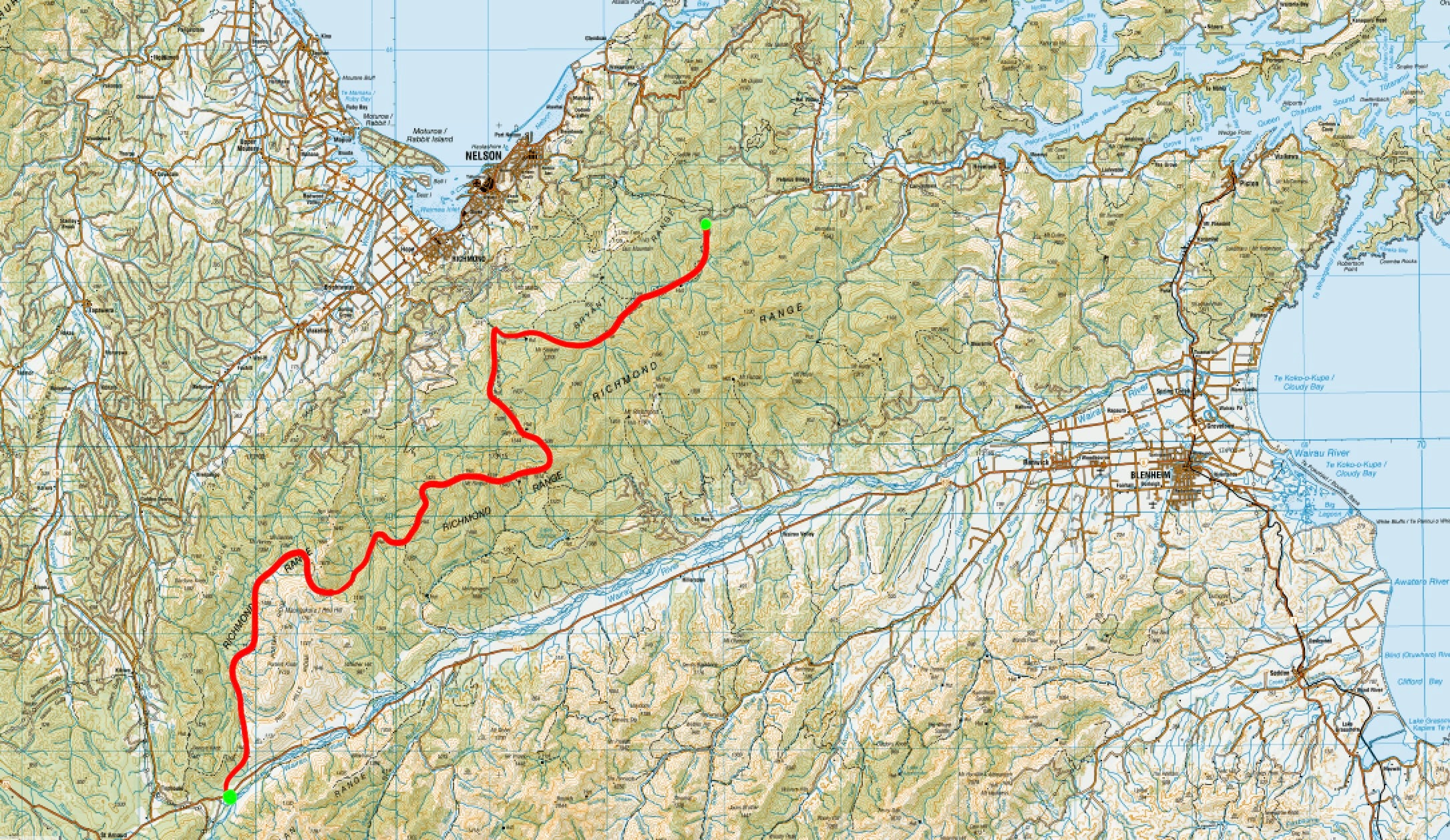
The Richmond Alpine track crosses the mountains that separates Nelson from the Nelson Lakes; the Richmonds Ranges. A 7-8 day tramp through a wide variety of terrain pushing you to your absolute limit.
To quote some of my notes during this section:
“The Richmond ranges is a seemingly endless expanse of peaks and valleys, the trail frustratingly zig zags its way through this expanse and each day feels like a pinprick of progress in this massive 8 day section. With every inch being either a steep incline or an acute decline, progress is painstakingly slow.”
To make things easier to digest we can break down the Richmond Ranges into a few different sections.
- Red Hills: 2 Days
- Wairoa River: 1 Day
- Ridge-line Hopping: 2 Days
- Beech Wandering: 2 Days
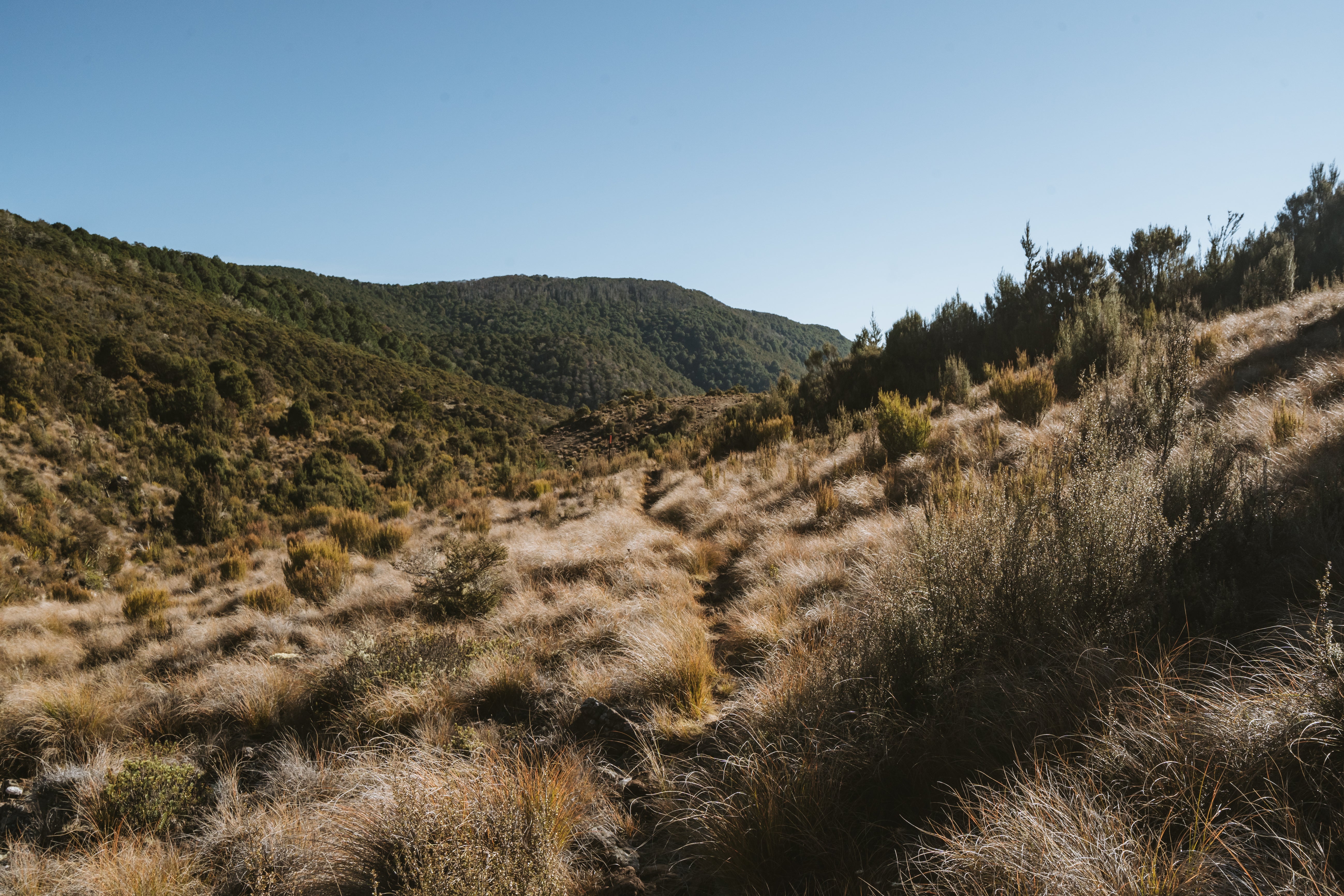
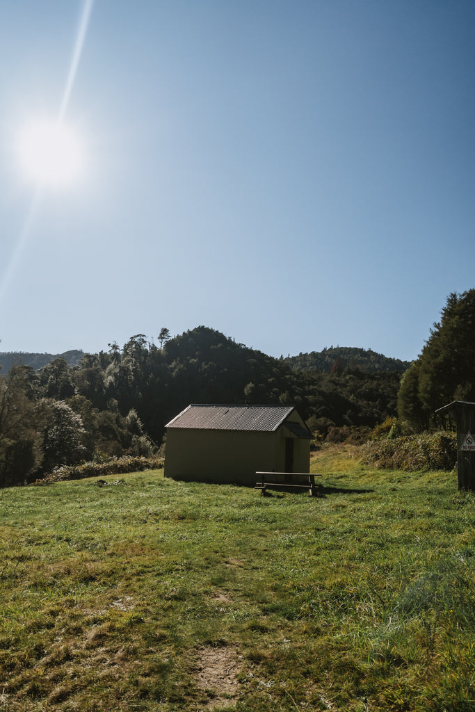
Red Hills
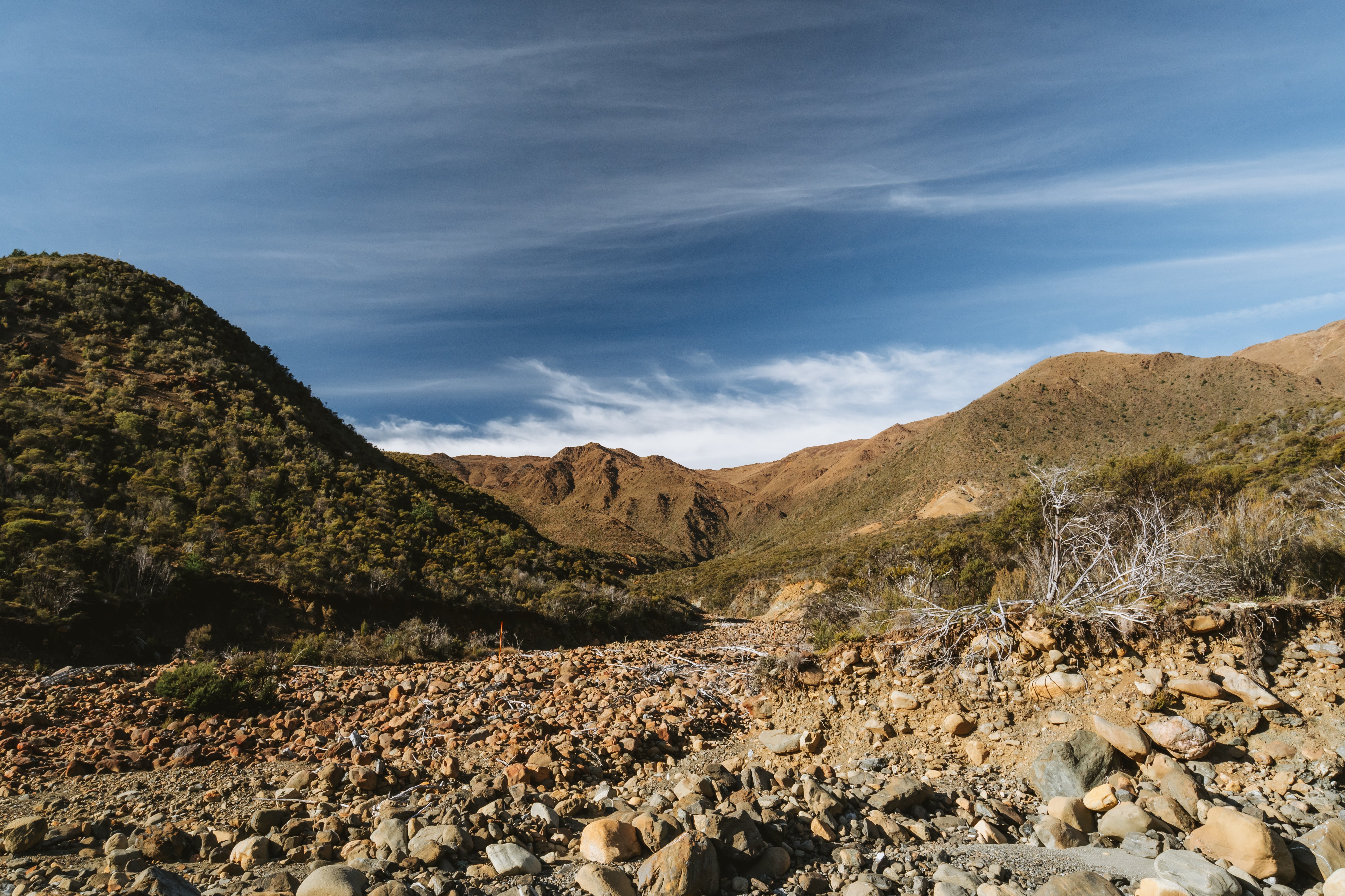
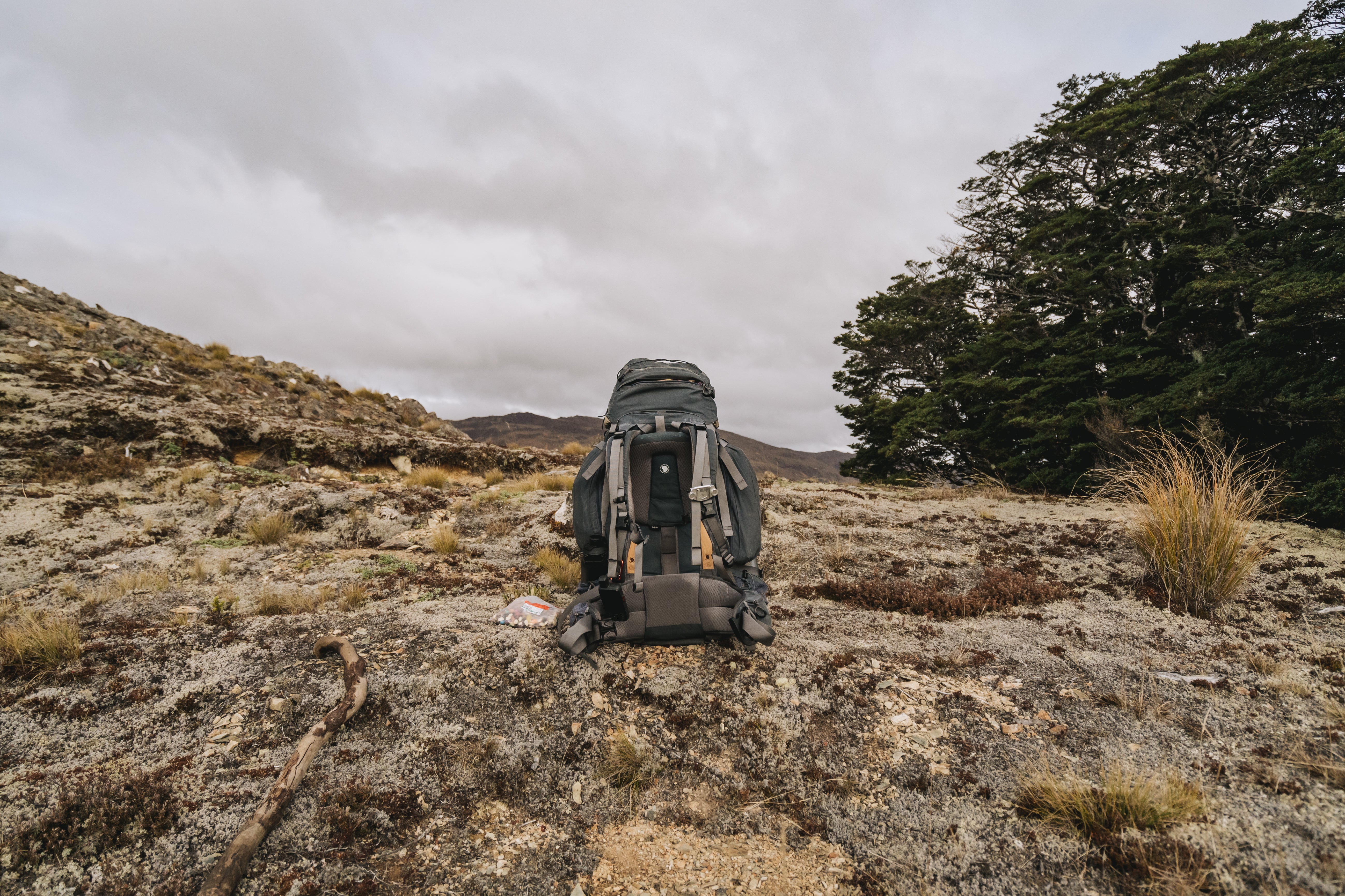
The aptly named Red Hill is an awesome start to this section. NZ has some strange names for places, sometimes they fit, sometimes they're named after some old geezer, but most of the time they just seem like weird choices. Red Hill is exactly what it sounds like, a bright red hill. Somewhat reminiscent of a desert; the rocks and soil here are shades of red or orange, this is due to the Richmond Ranges being a part of the Nelson Mineral Belt, I’m sure a geologist could explain this better than me but essentially the earth here is rich in rare minerals that give it the bright red and orange tinge and also stunts the growth of vegetation giving the area it’s desert like appearance.

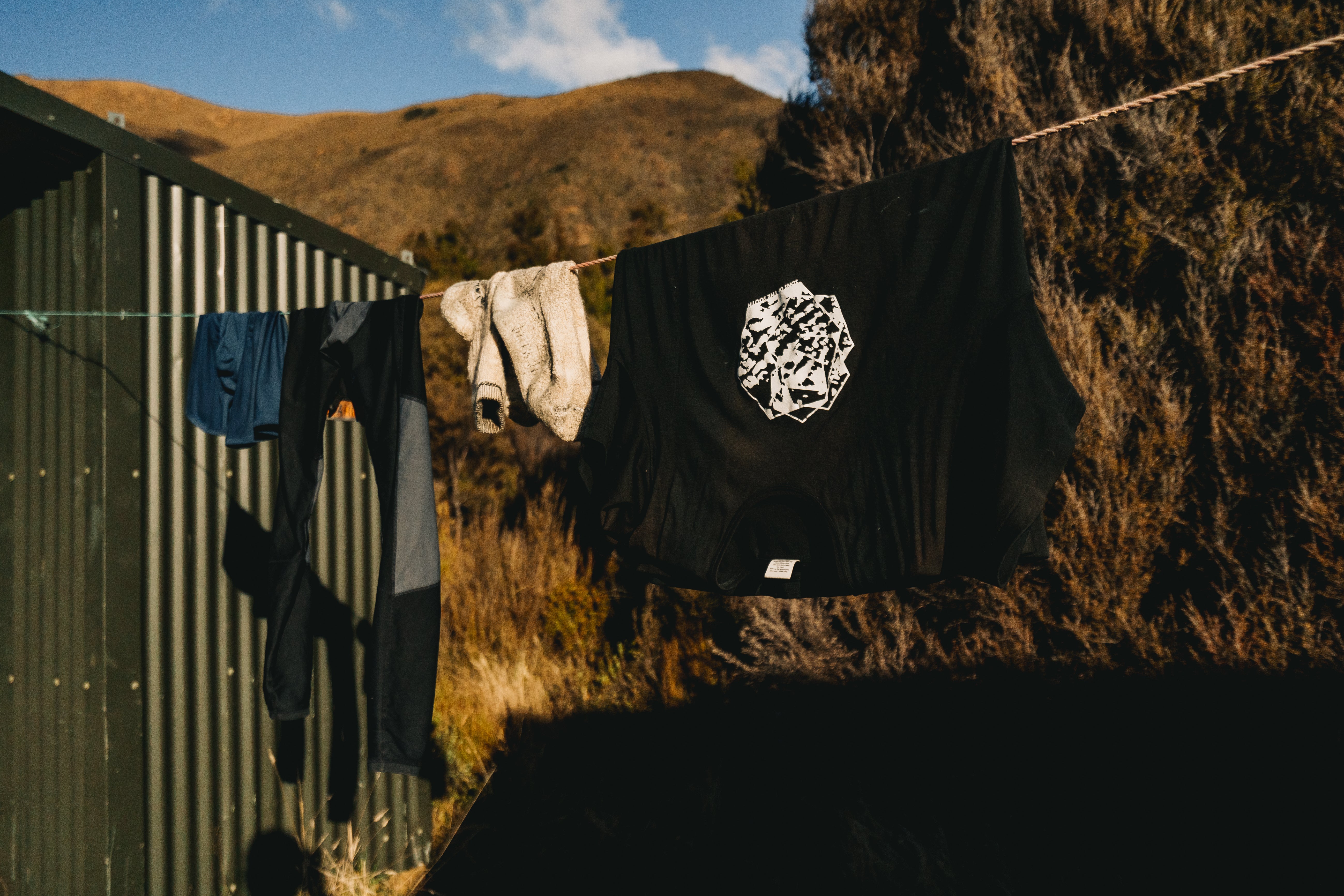
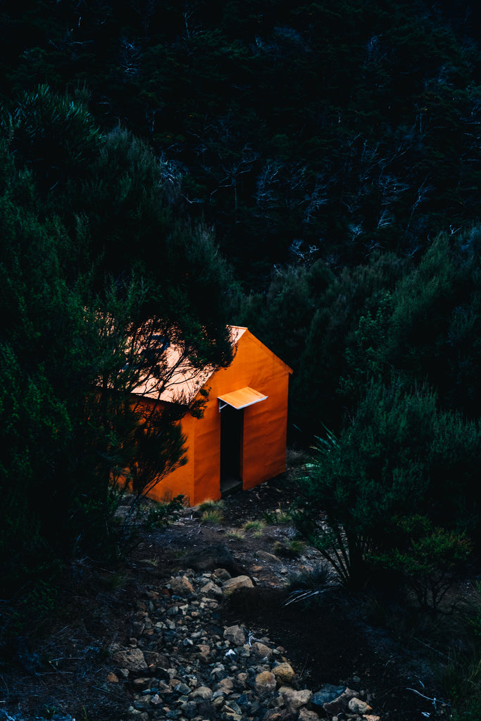
There are plenty of huts in this section; Red Hills, Porters Creek, Hunters, and Top Wairoa Hut. If you can make it all the way to Hunters Hut I would highly recommend stopping there as the view is spectacular but be wary of Weka here, they will steal your sherbet fizz.

You’ll then spend the next 5 hours walking in a giant semi circle up and over Mt Ellis staring back at the hut you just came from. It’s this kind of bullshit that makes the Richmond Ranges frustratingly hard, while it feels like you’re covering a lot of ground the route you’re taking gives you minimal northbound progress.
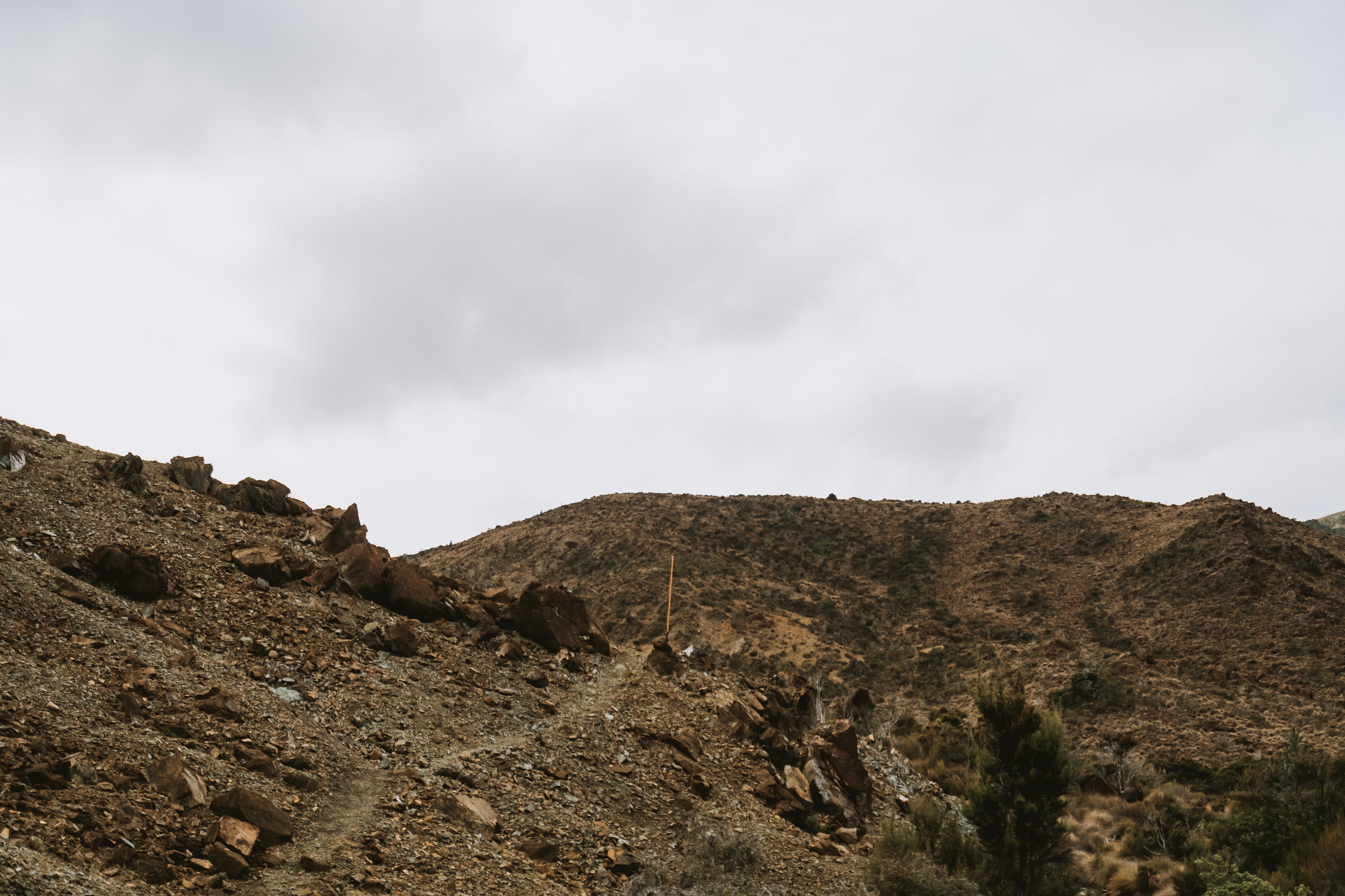
Whatever way you decide to tackle the Red Hills make sure you stop at Top Wairoa Hut because the next section is a real bitch.
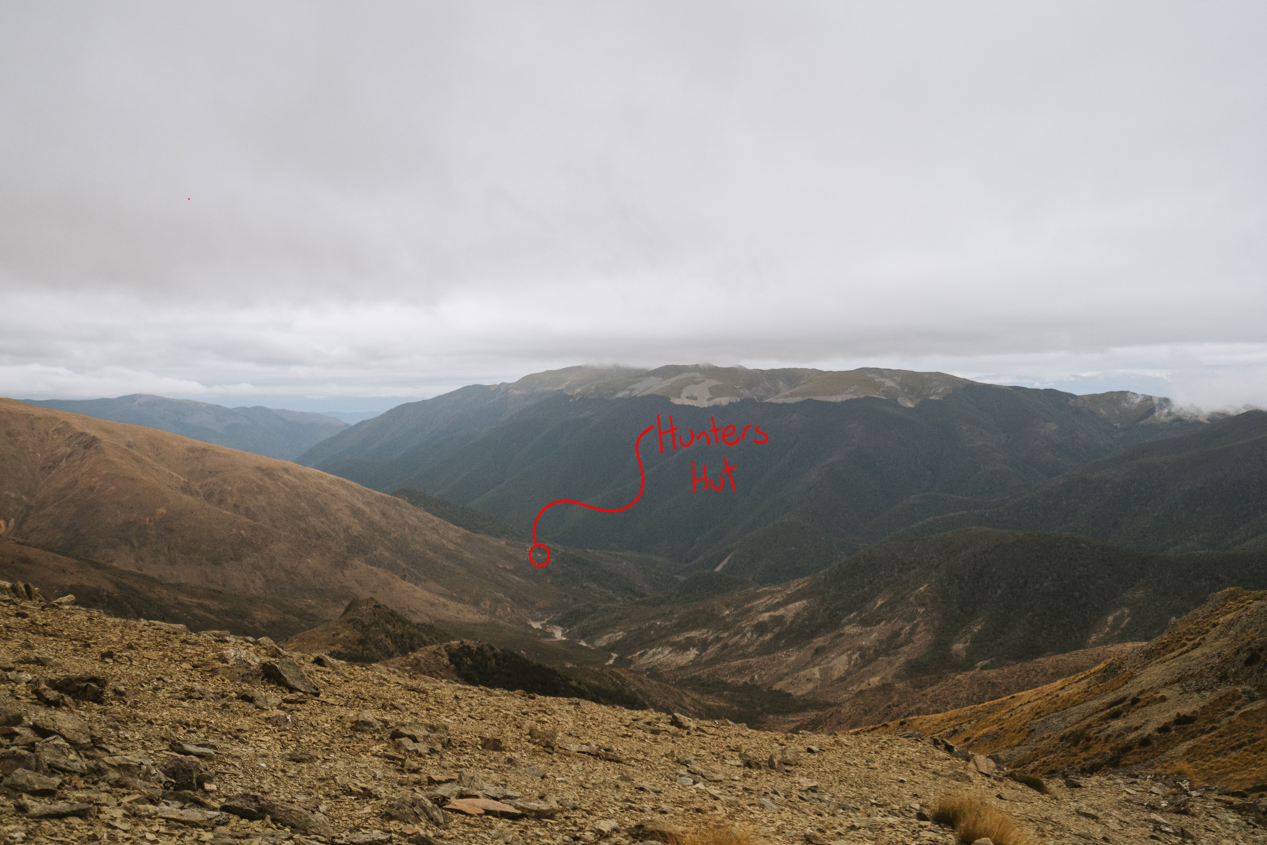
Wairoa River
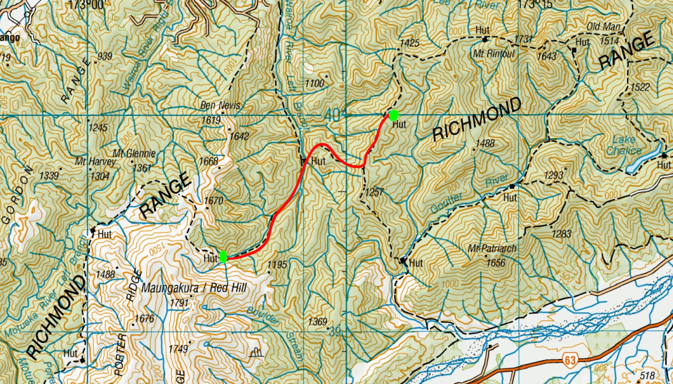
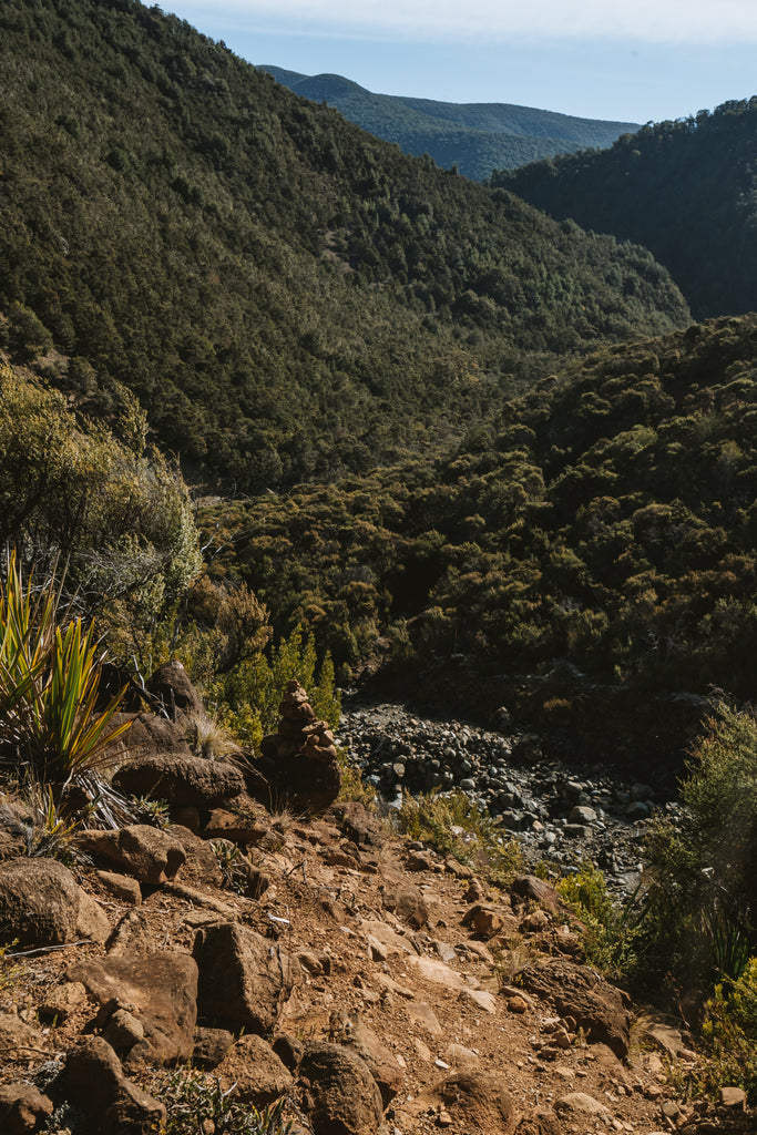
You can always tell which days I found difficult or frustrating because there are next to no photos taken for that day. Following the Wairoa River is a difficult and technical part of the trail, I did it in a torrential rainstorm making progress slow and slippery. The track sidles the river, crossing it about 8-9 times. More often than not you're climbing steep rock faces above massive drops to the river below, and with plenty of places where the trail has clearly dropped away to the river 50 feet below you’ll want to make sure every step you take is the right one.
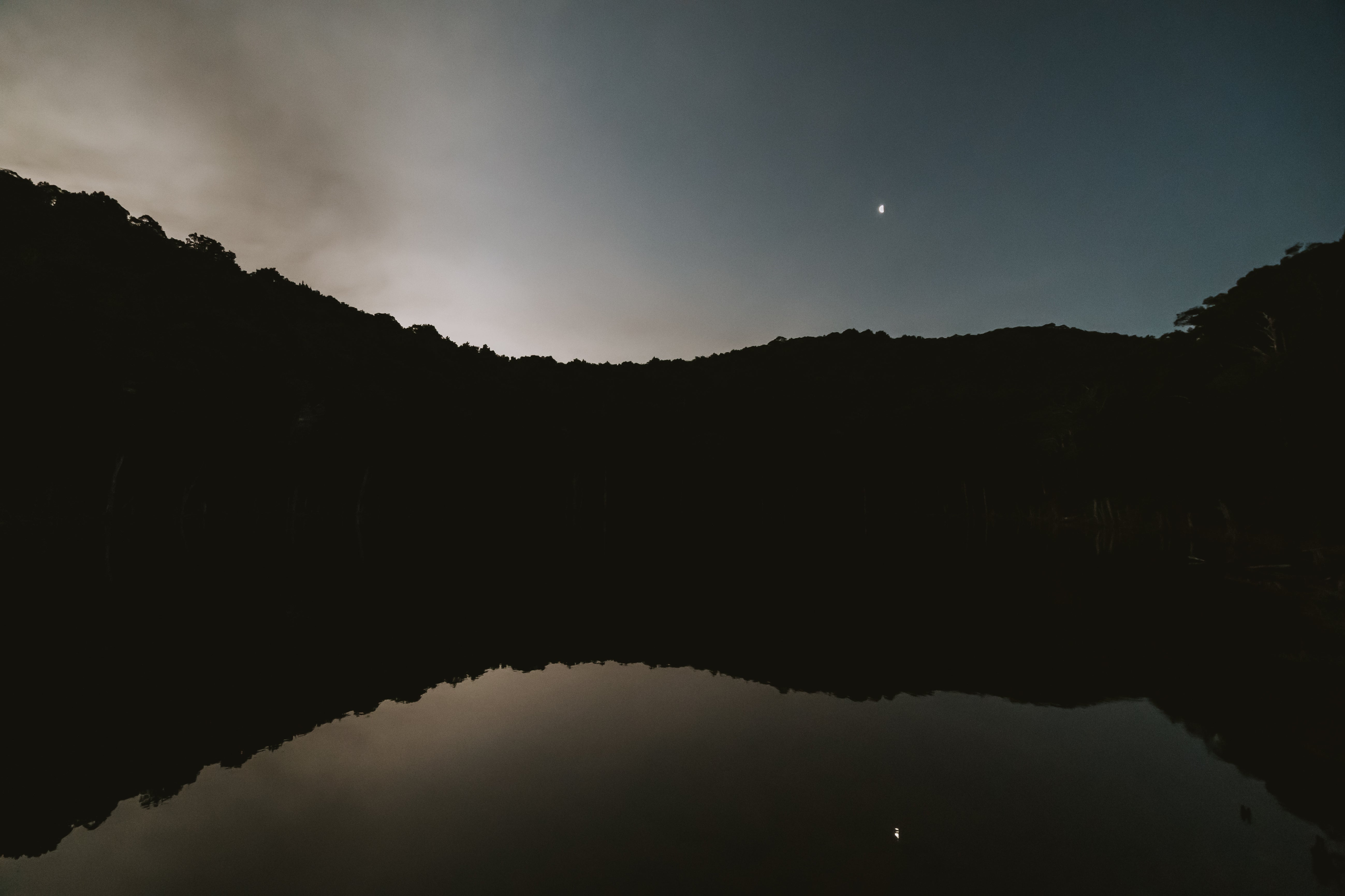
Eventually you arrive at Mid Wairoa Hut where I collapsed into a heap, opened up my 3rd and final bag of sherbet fizz, and demolished it on the spot. Fuel up here because there’s a step ascend to the top of the ridge-line to Tarn Hut, which is worth staying in for the picturesque tarn 5 metres away. Also to quote my notes from that night “The fireplace at tarn hut goes hard. I had it hotter than a sauna in there”
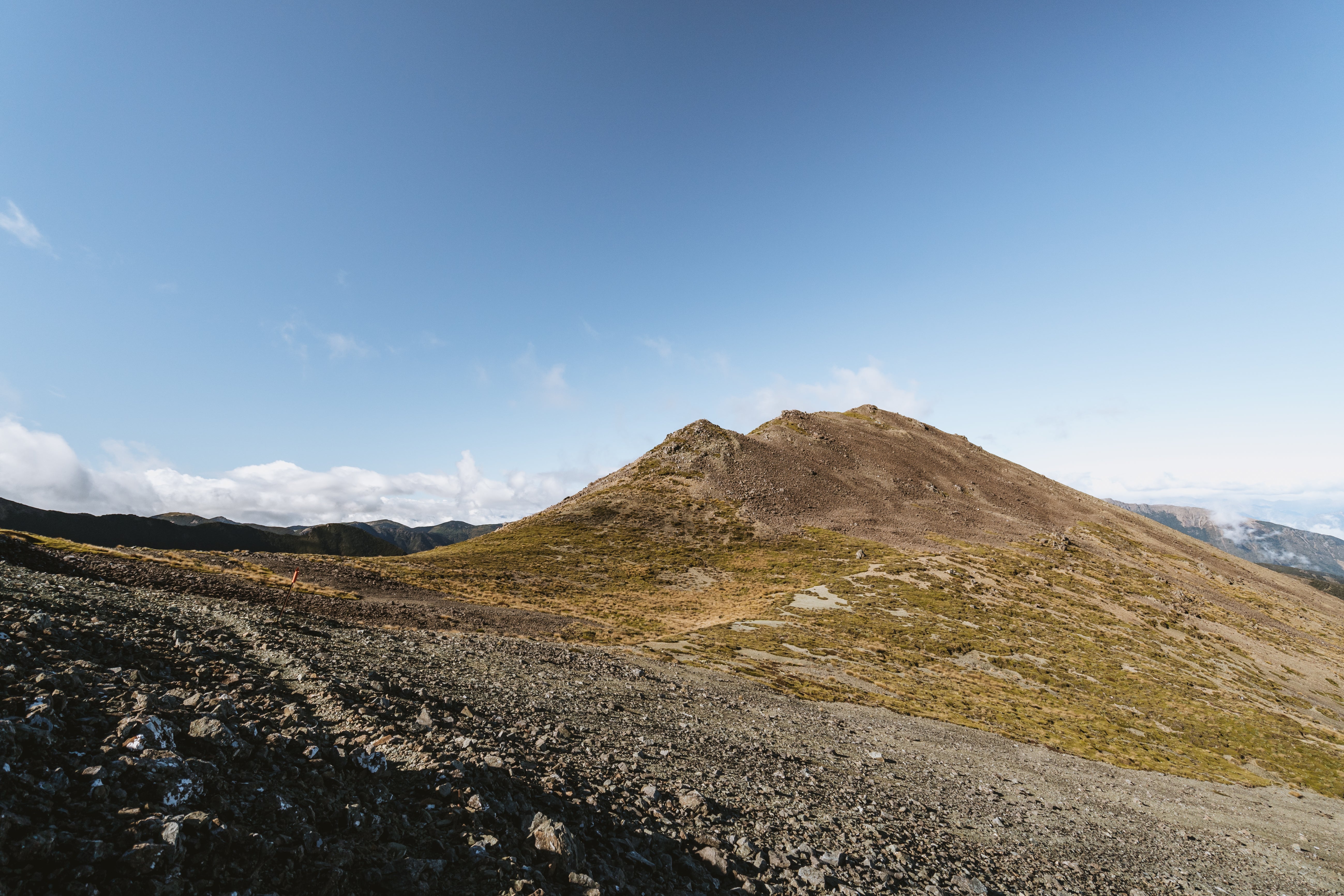
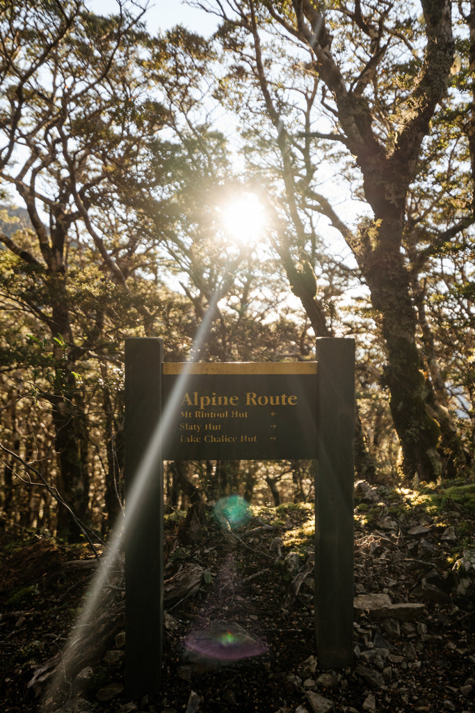
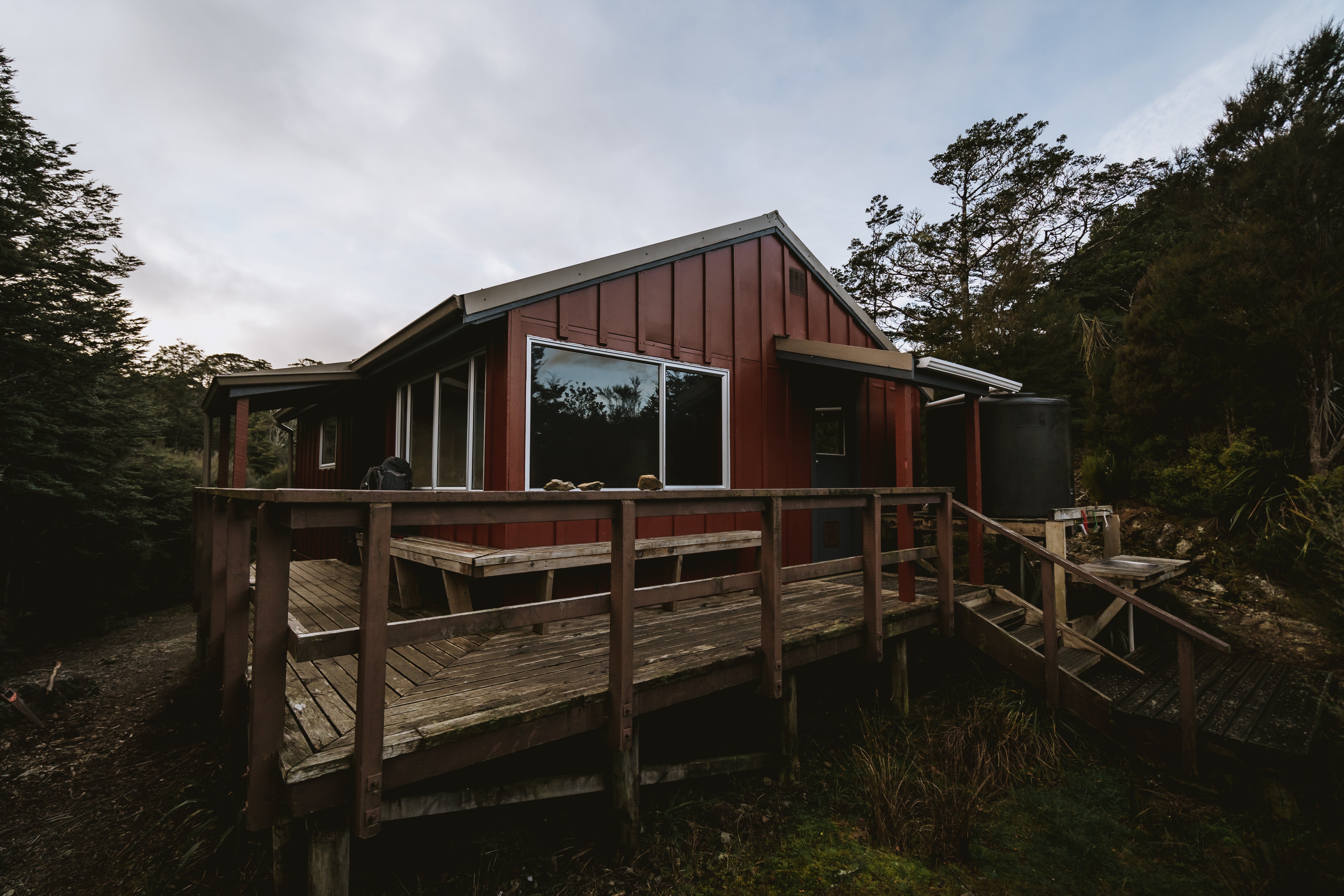
 Ridge-line Hopping
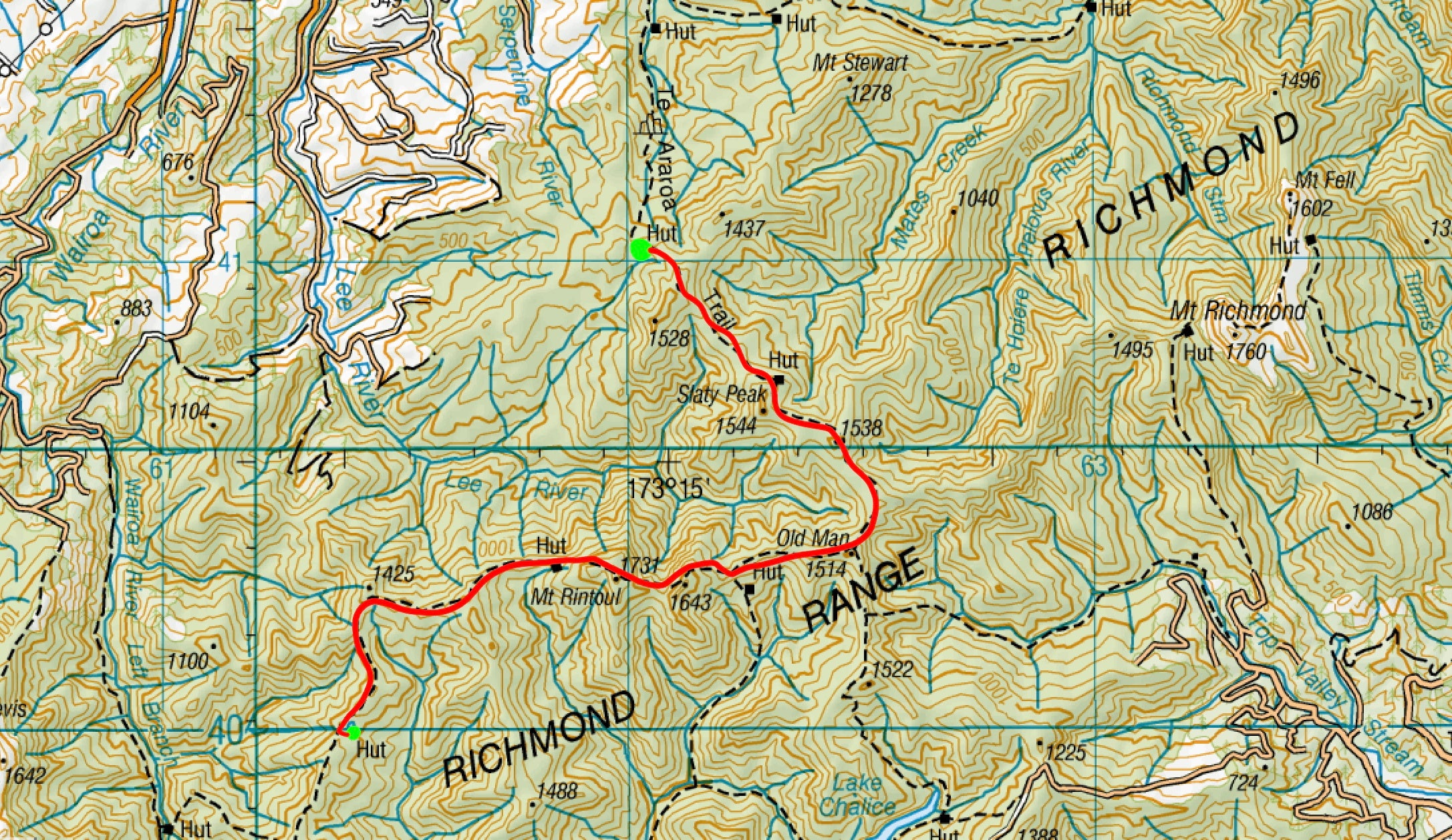
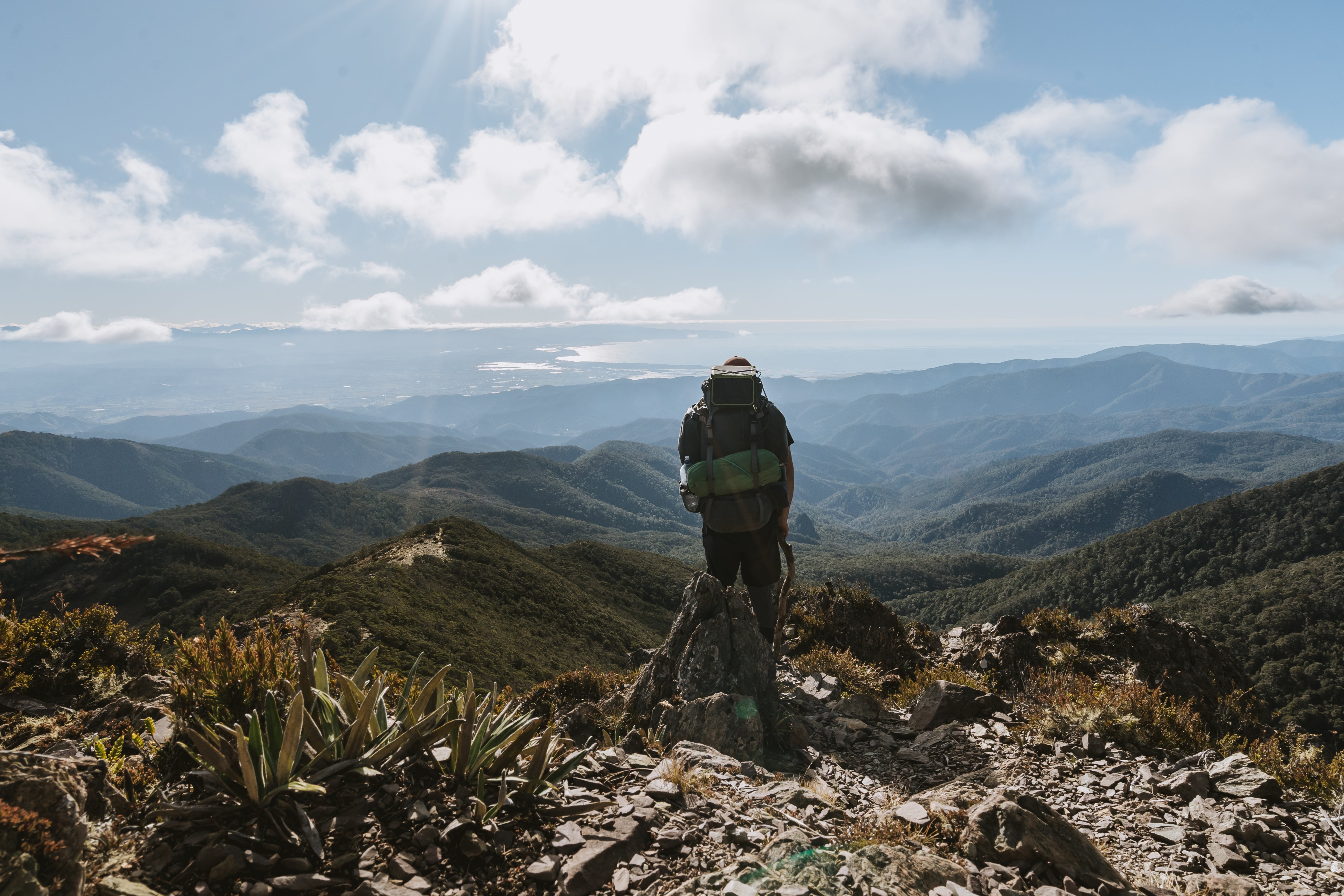
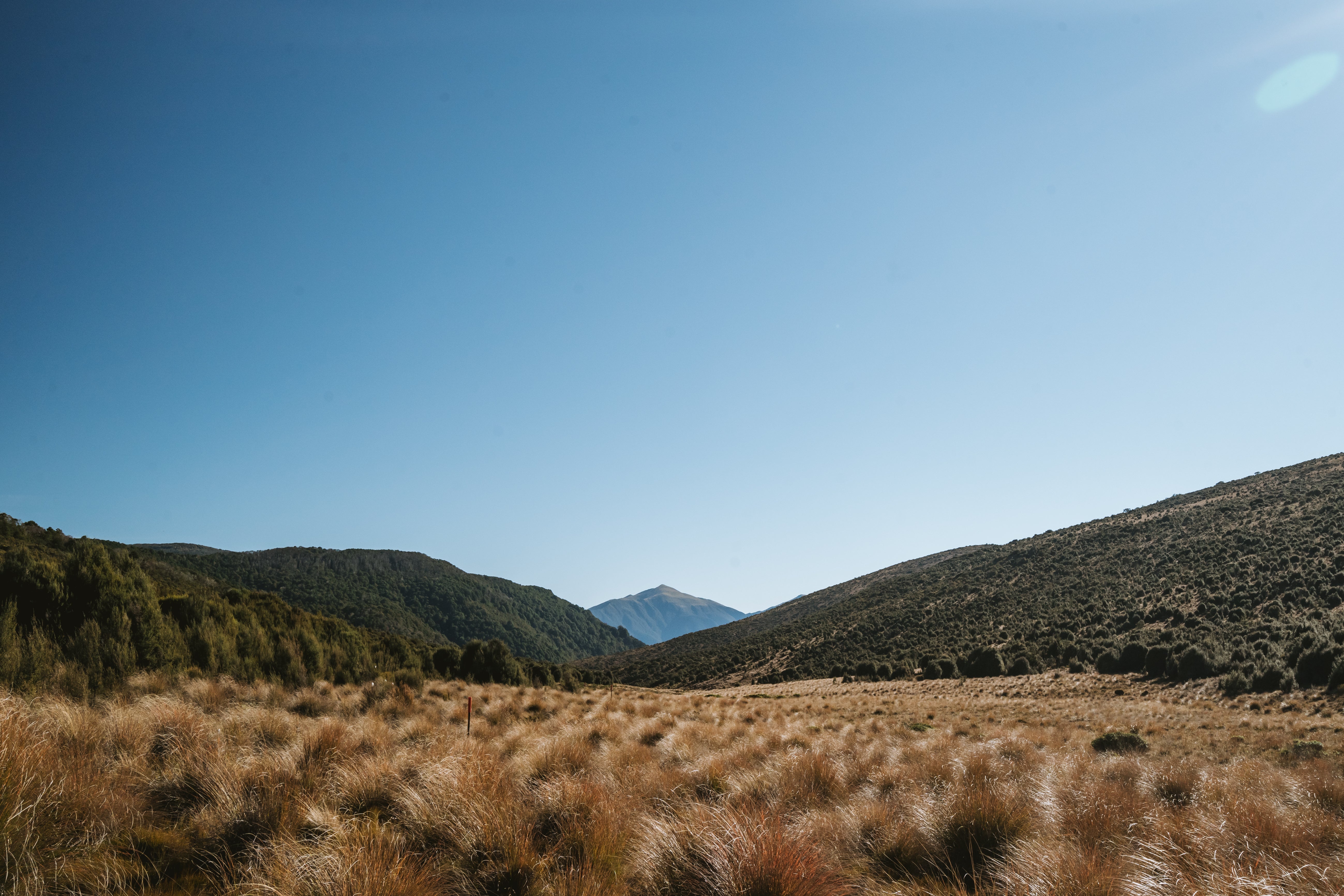
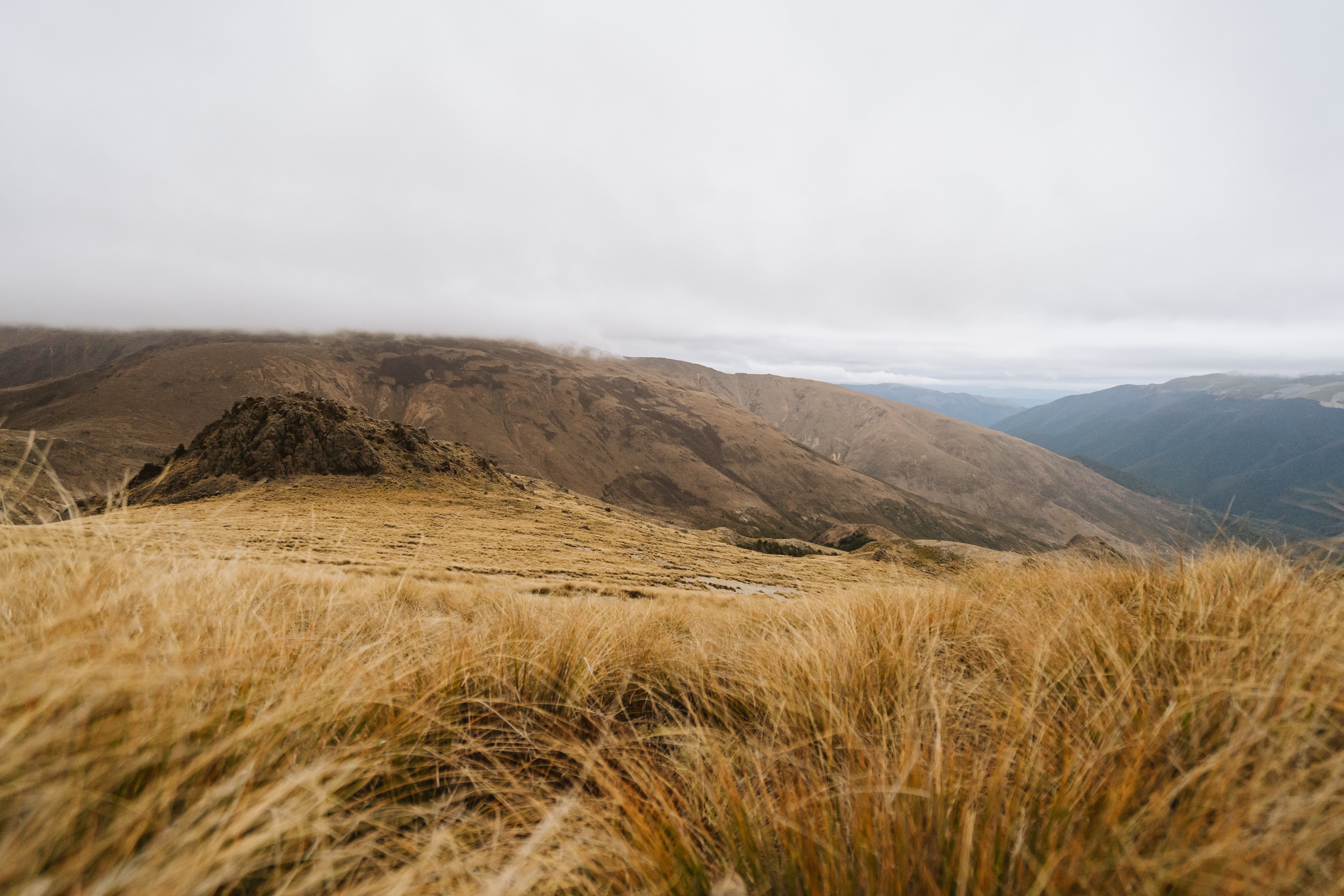
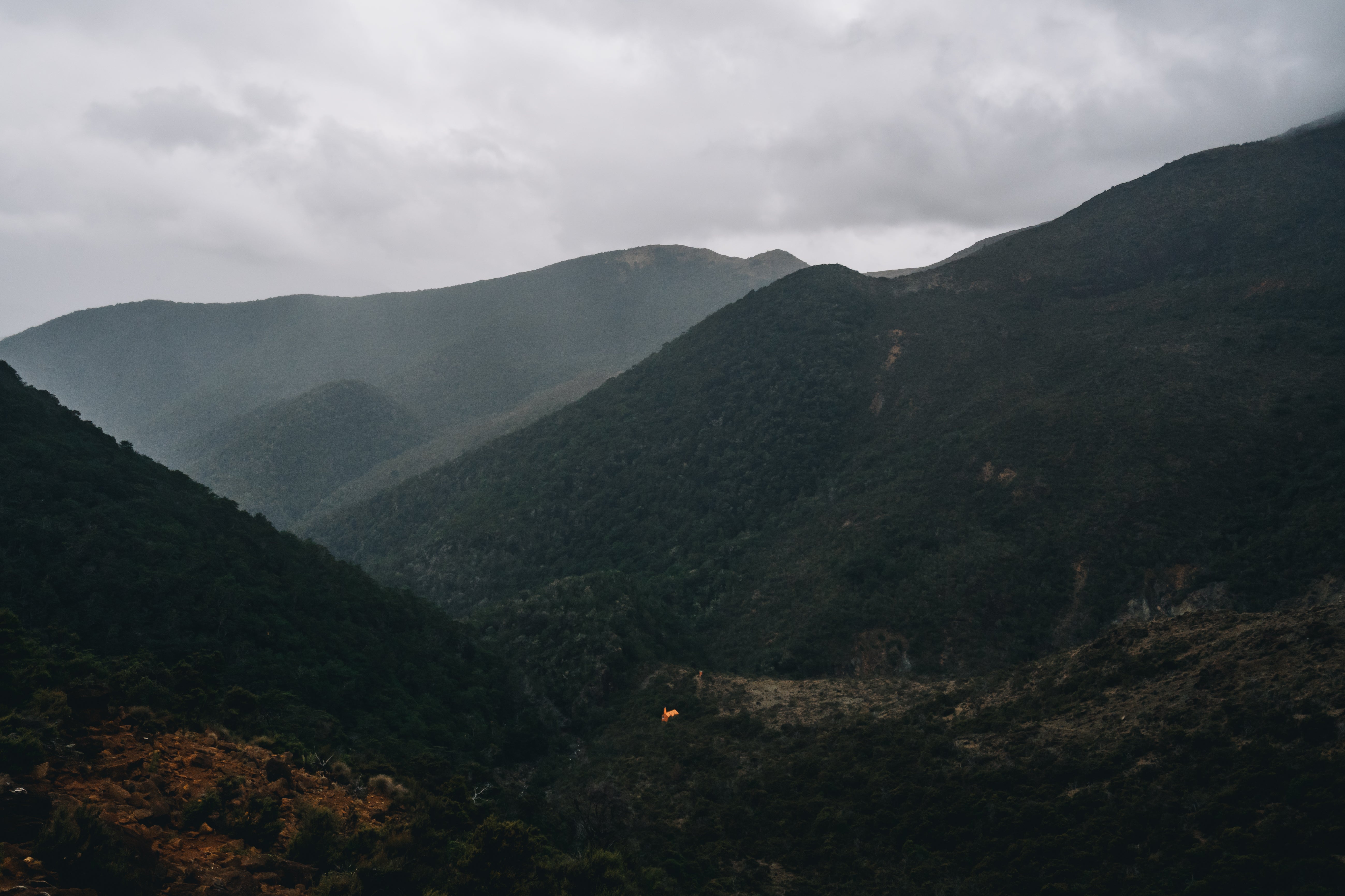
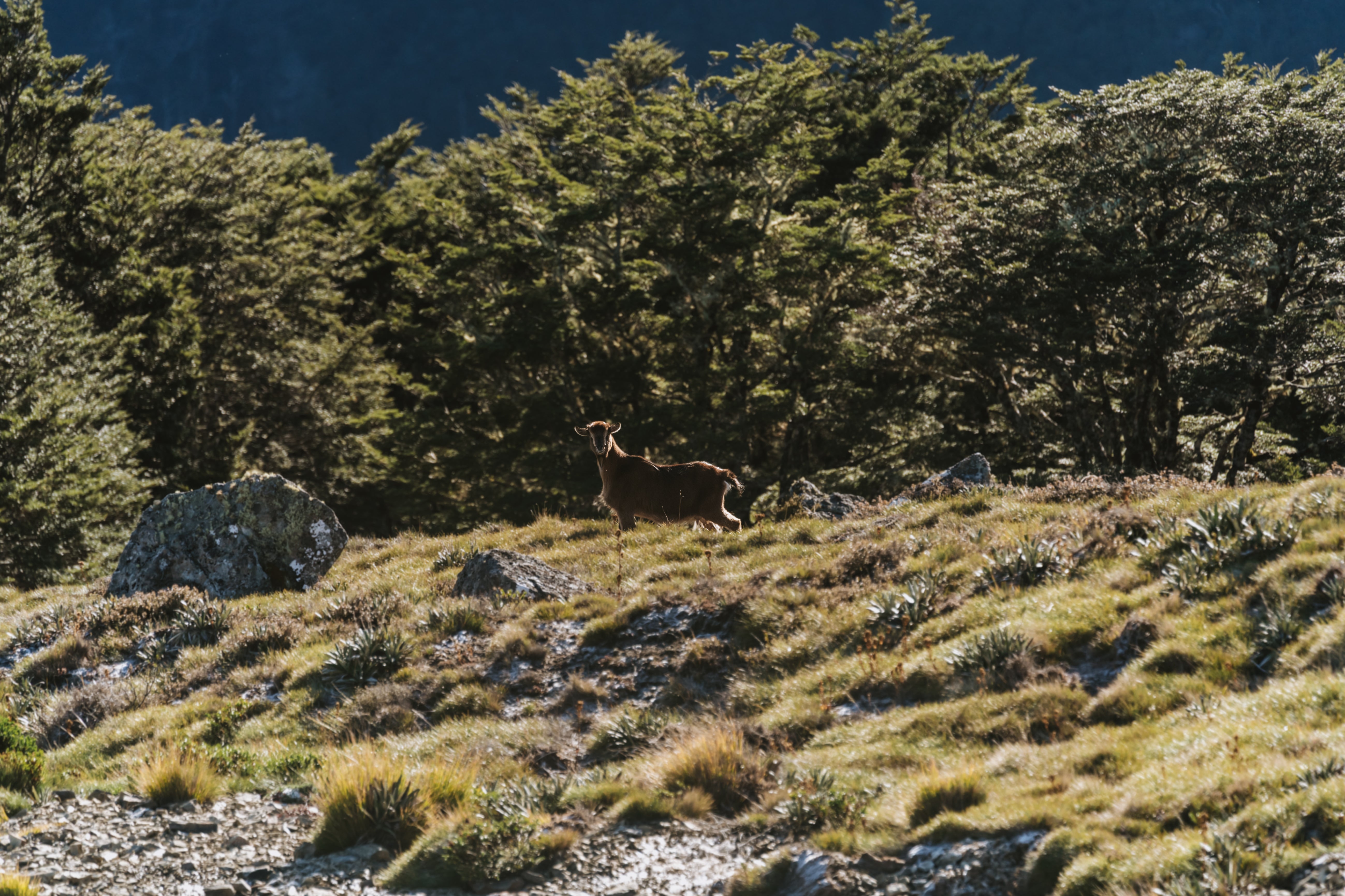
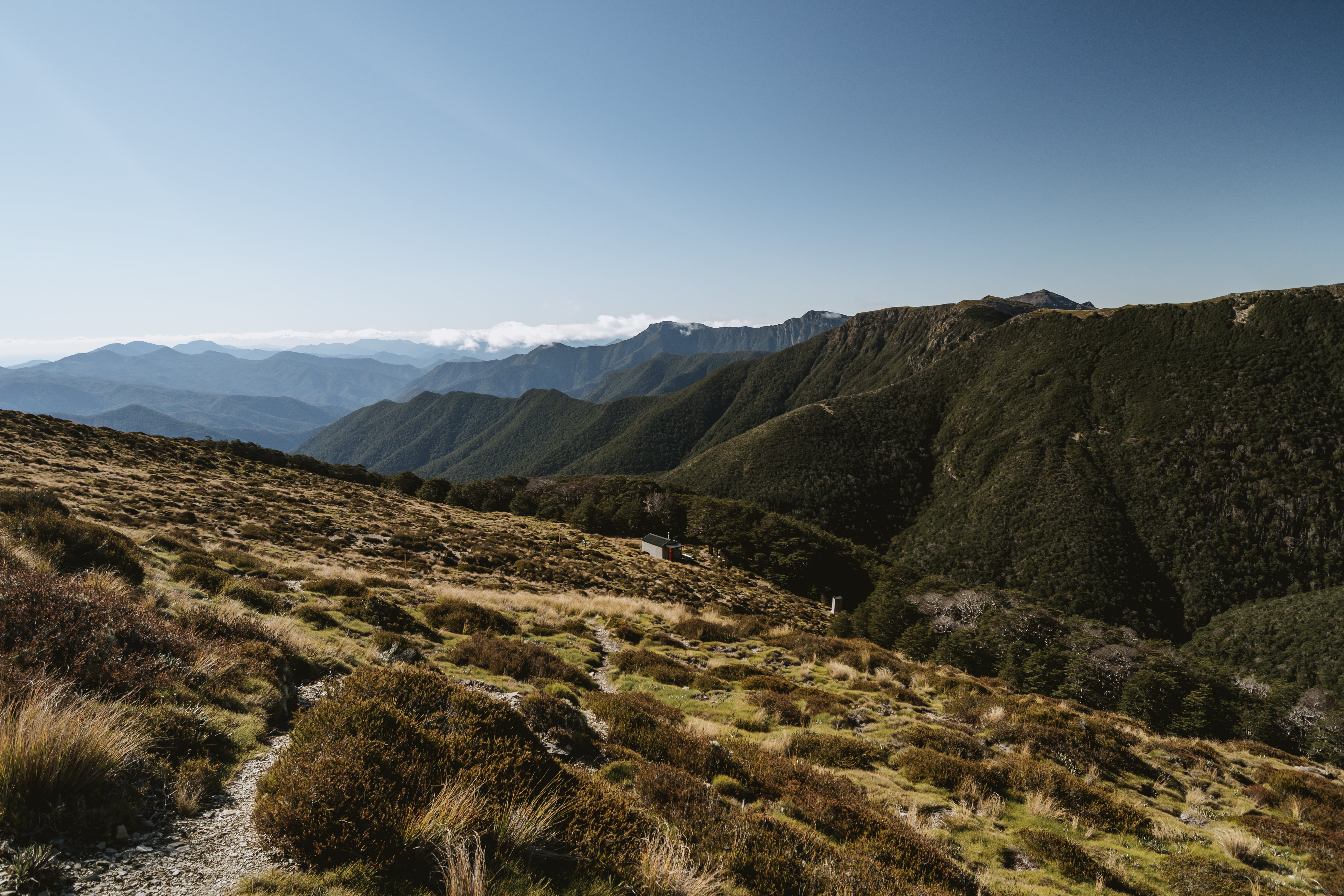
You’re now sitting at altitude (around 1000 metres) and the next few days were some of my favourite days on Te Araroa. Following the ridge-line that creates the border between Tasman and Marlborough. Popping in and out of stunted beech trees you can see the massive expanse called the Richmond Ranges.

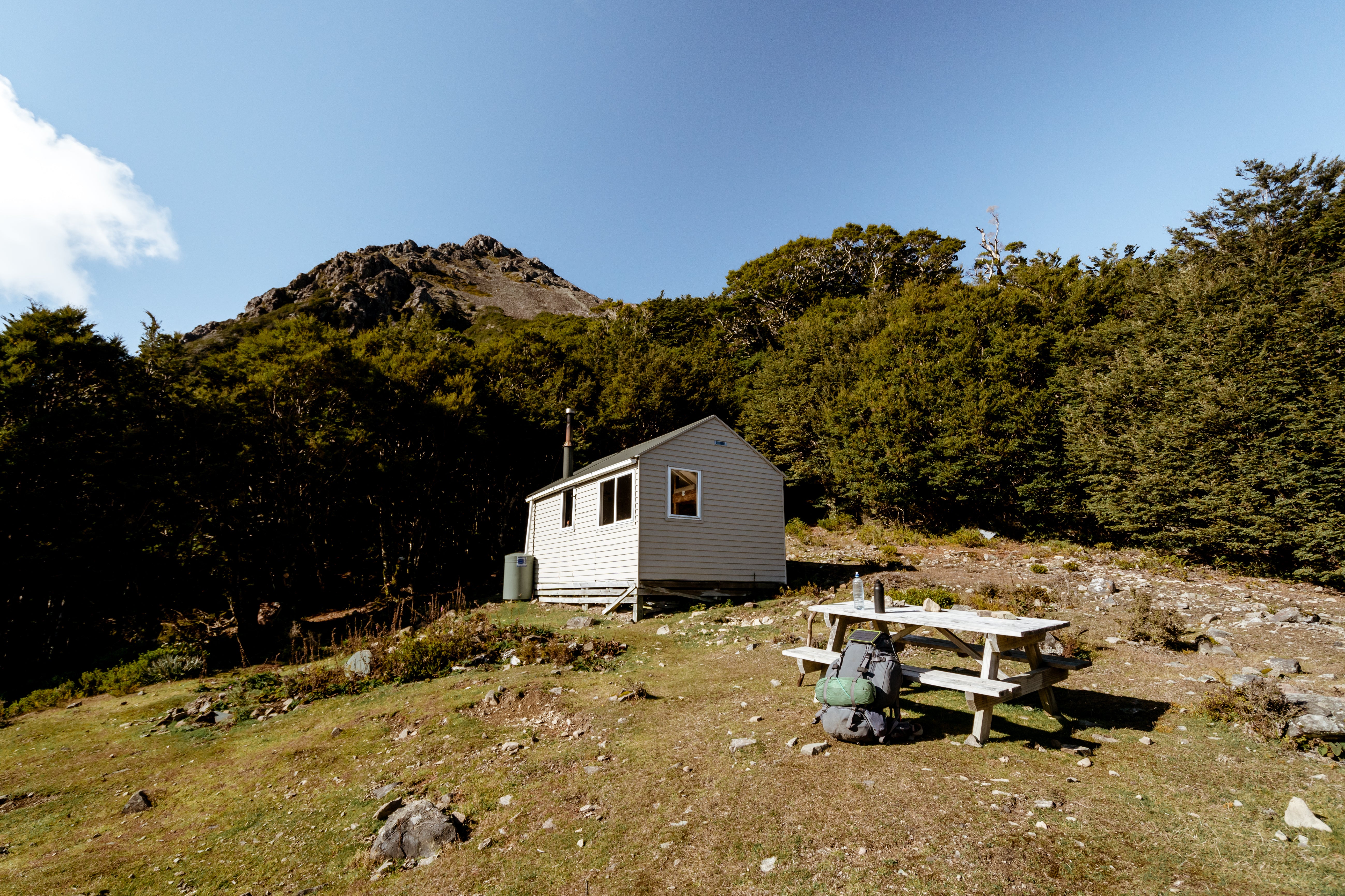
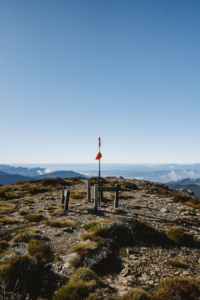
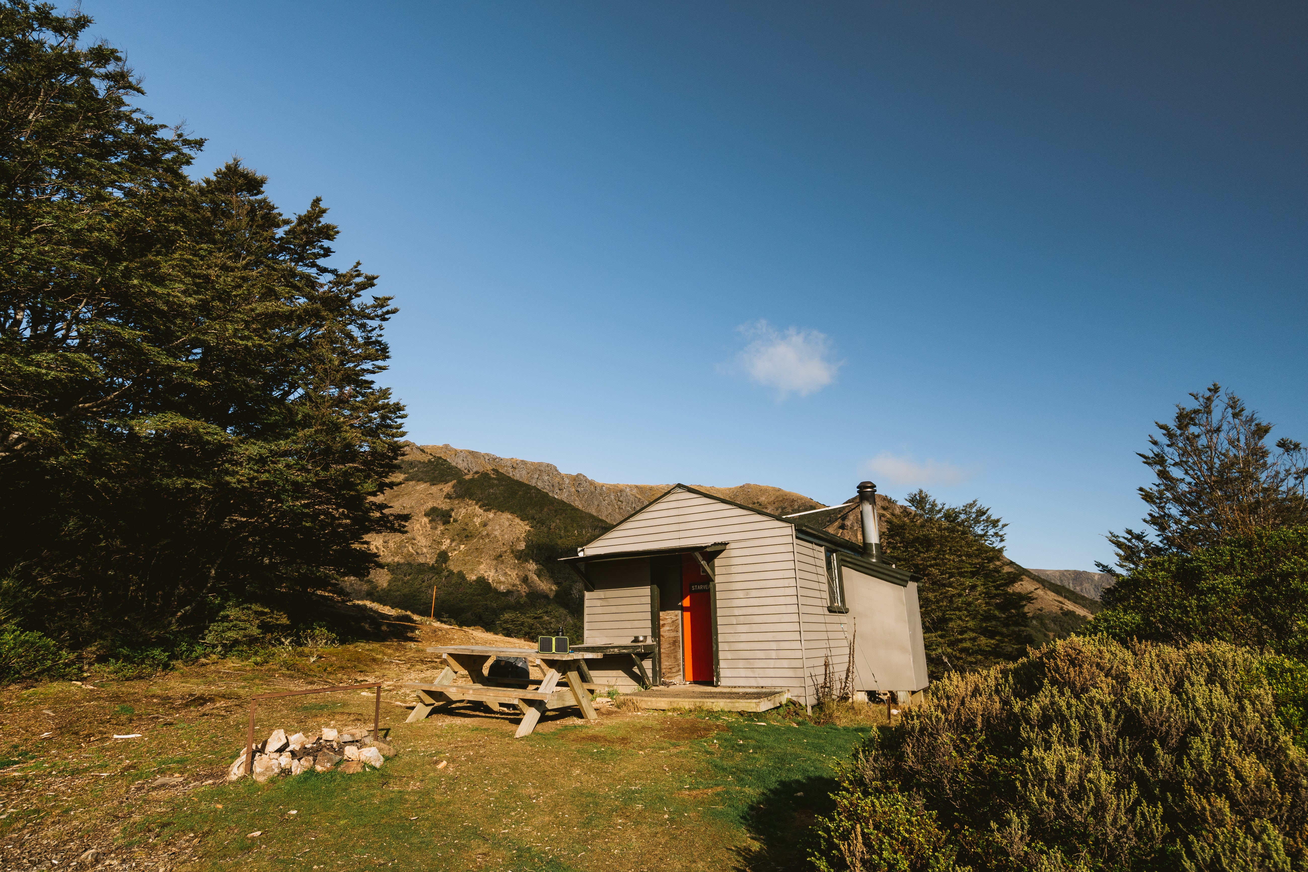
The next few days will see you summiting multiple peaks as you hop from ridge-line to ridge-line; Purple Top, Mt Rintoul, Little Rintoul, Old Man, Slaty Peak, and Mt Starveall. There are 4 different huts that make up this section, but they’re awkwardly spaced which makes segmenting your days up difficult. I stayed in Old Man Hut and highly recommend that you don’t, it’s a 30 minute steep detour off the ridge-line and the view isn’t particularly inspiring (I don’t think I even took a photo of it if that tells you anything). Rintoul Hut and Starveall Hut however were incredible so try slotting those in if you can.
Leaving Tarn Hut you’ll summit Purple Top, another aptly named peak as the rocks and soil have a somewhat purple hue to them, check behind you after a few kms you’ll see what I mean. Then fuel up well at Rintoul Hut because you’re in for one hell of a section.
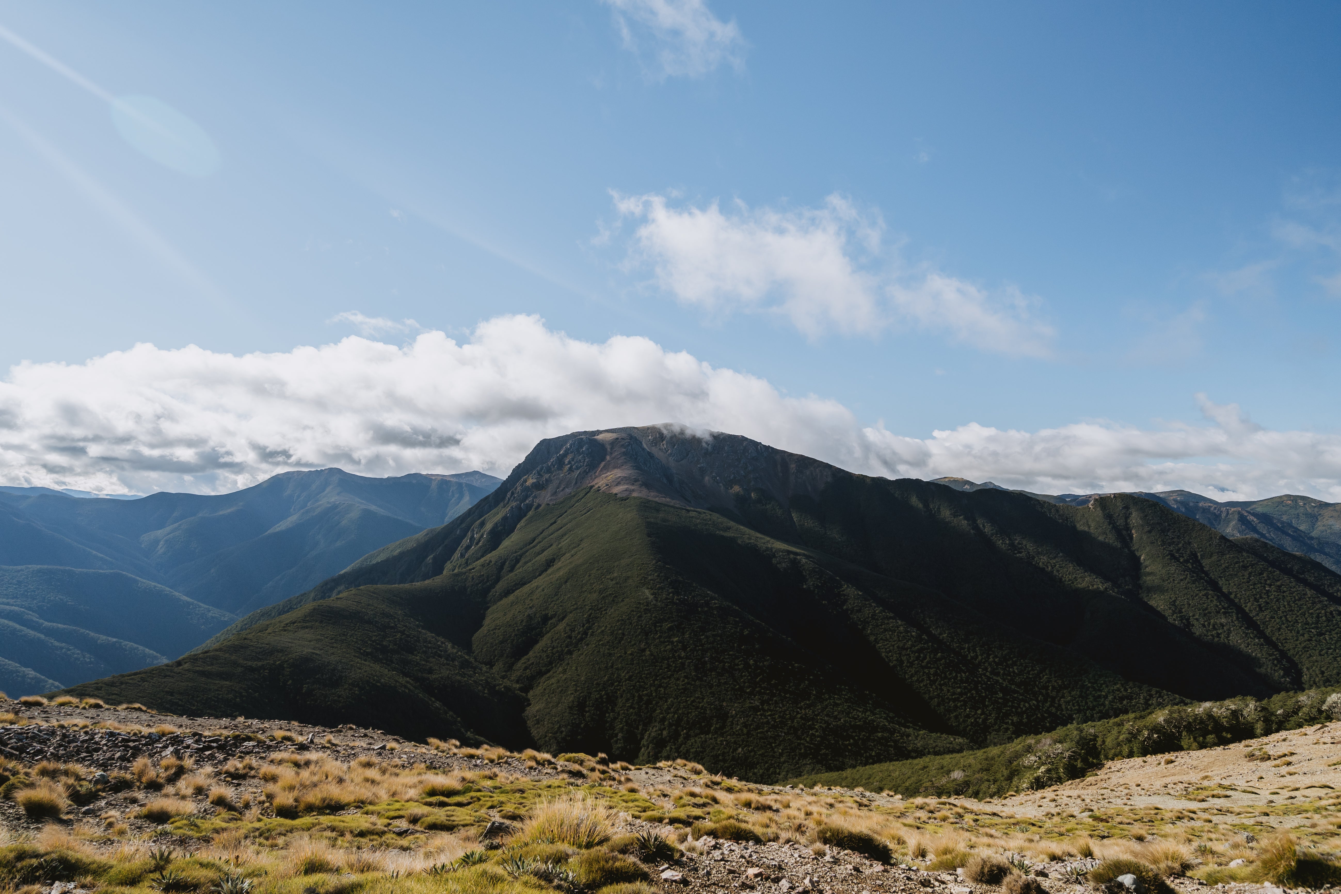
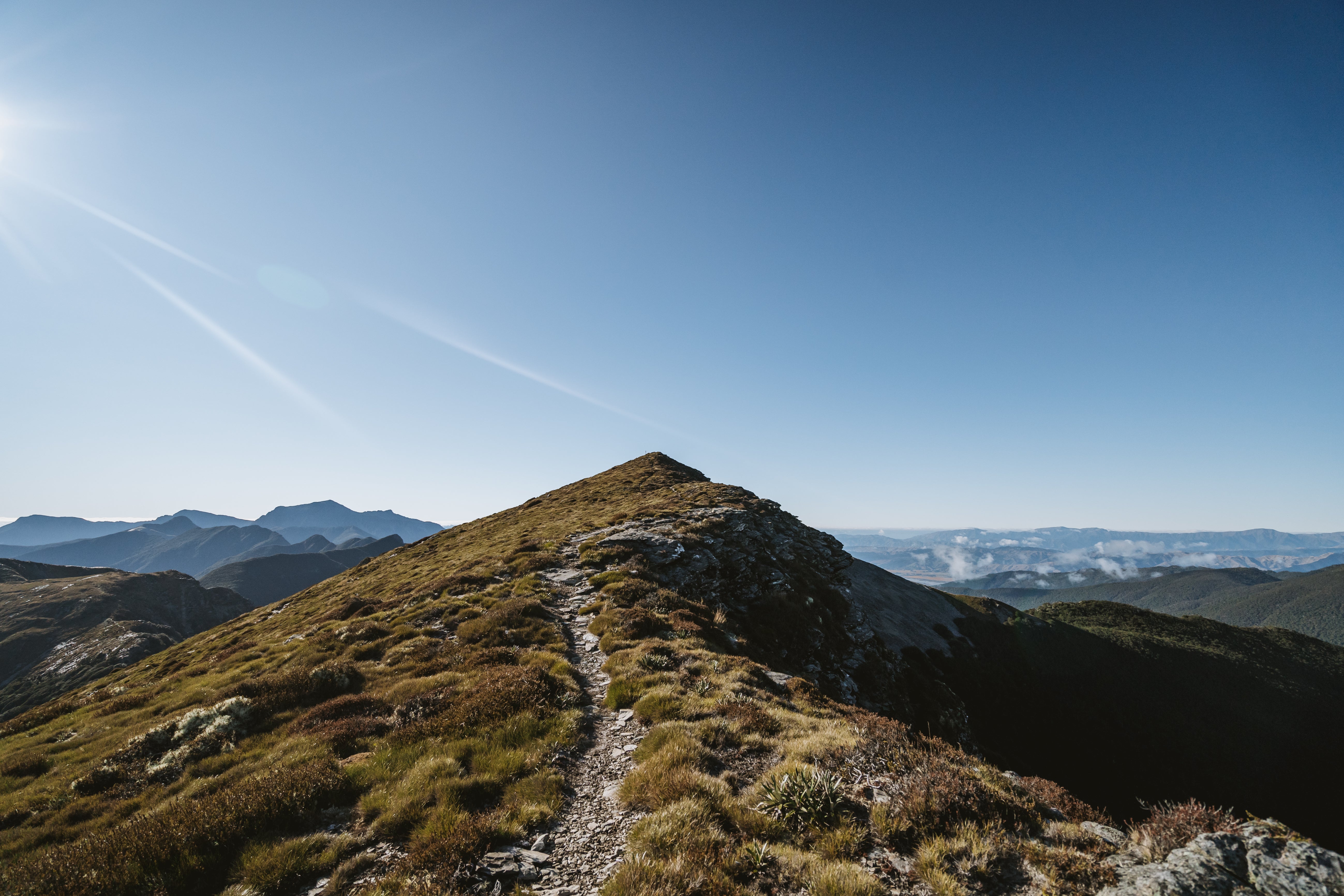
Mt Rintoul is infamously difficult, the climb up from the hut is just a taster as you steeply ascend up scree to the peak of Mt Rintoul, the highest point on this track.
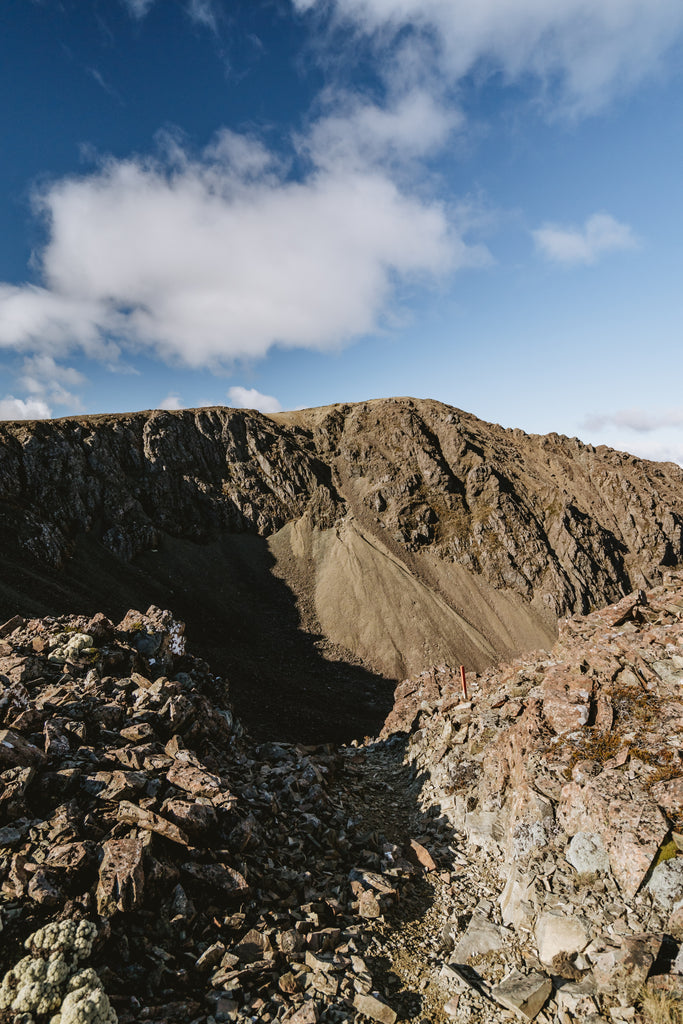
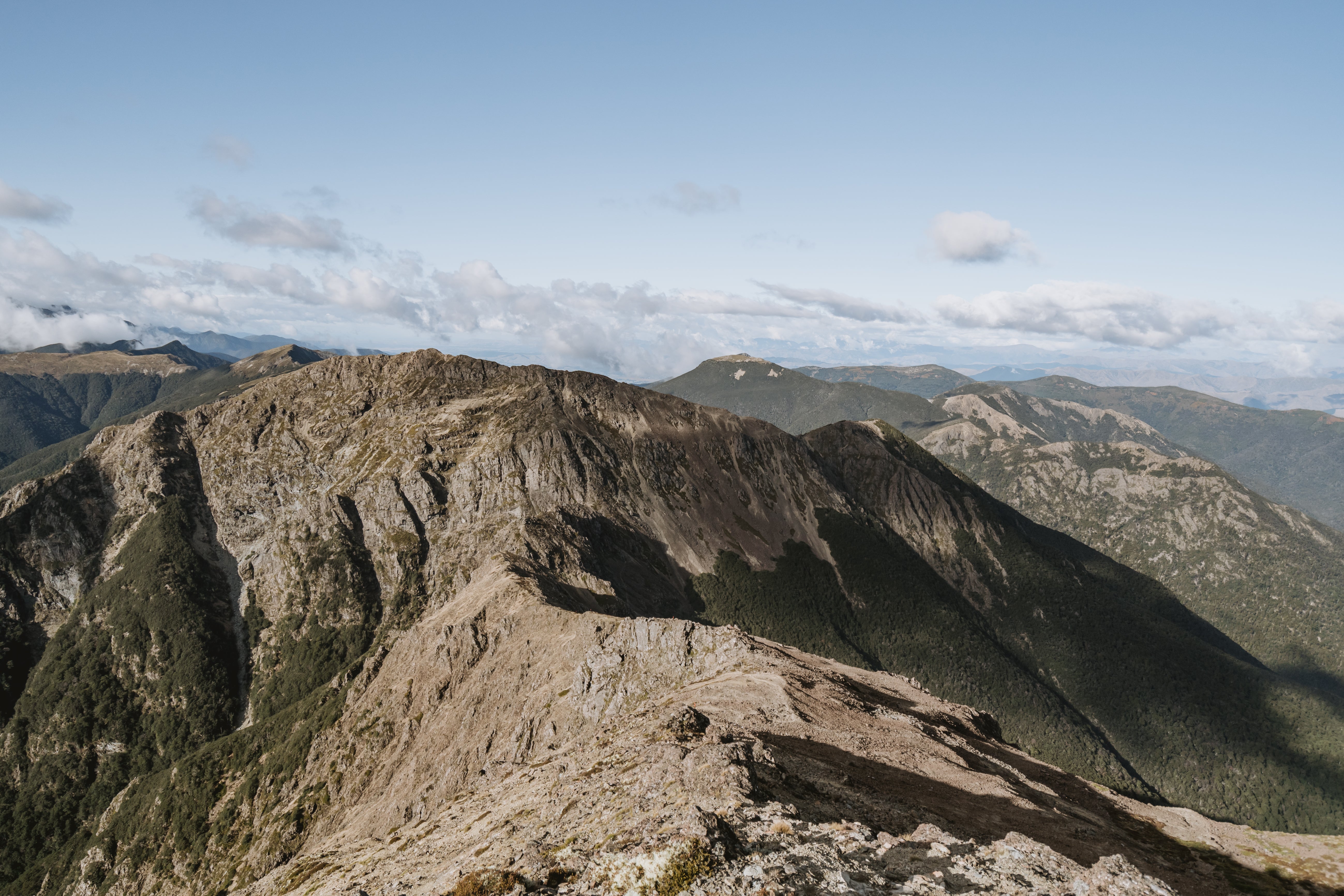
Wander over this terrifying peak to a dramatic landscape that looks like something out of a fairy tale. Staring across the valley you can see the track climbing the side of Little Rintoul… The next 2kms sees you drop incredibly steeply about 350m’s then climb back up Little Rintoul on an even steeper trail ascending about 250m’s.
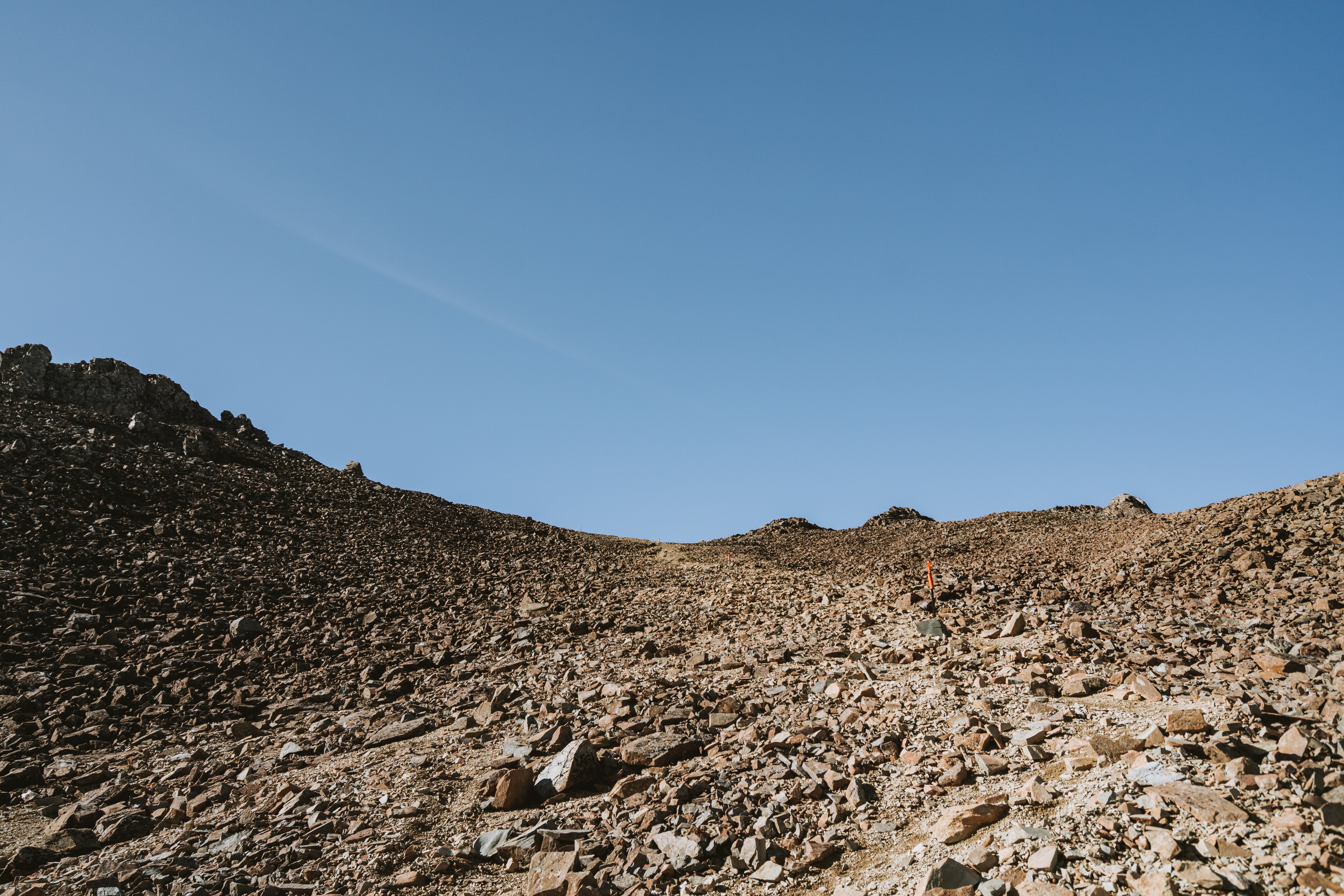
 If this just looks like cliff to you... then you would be right, but guess what... it's also where your track goes!
 Be prepared for a 4hr traverse from Rintoul Hut to the other side of Little Rintoul. Easily one of the most exciting and dramatic sections of Te Araroa, it’s well worth the multiple days it takes just to reach, and while it’s incredibly difficult to traverse it’s also incredibly satisfying.
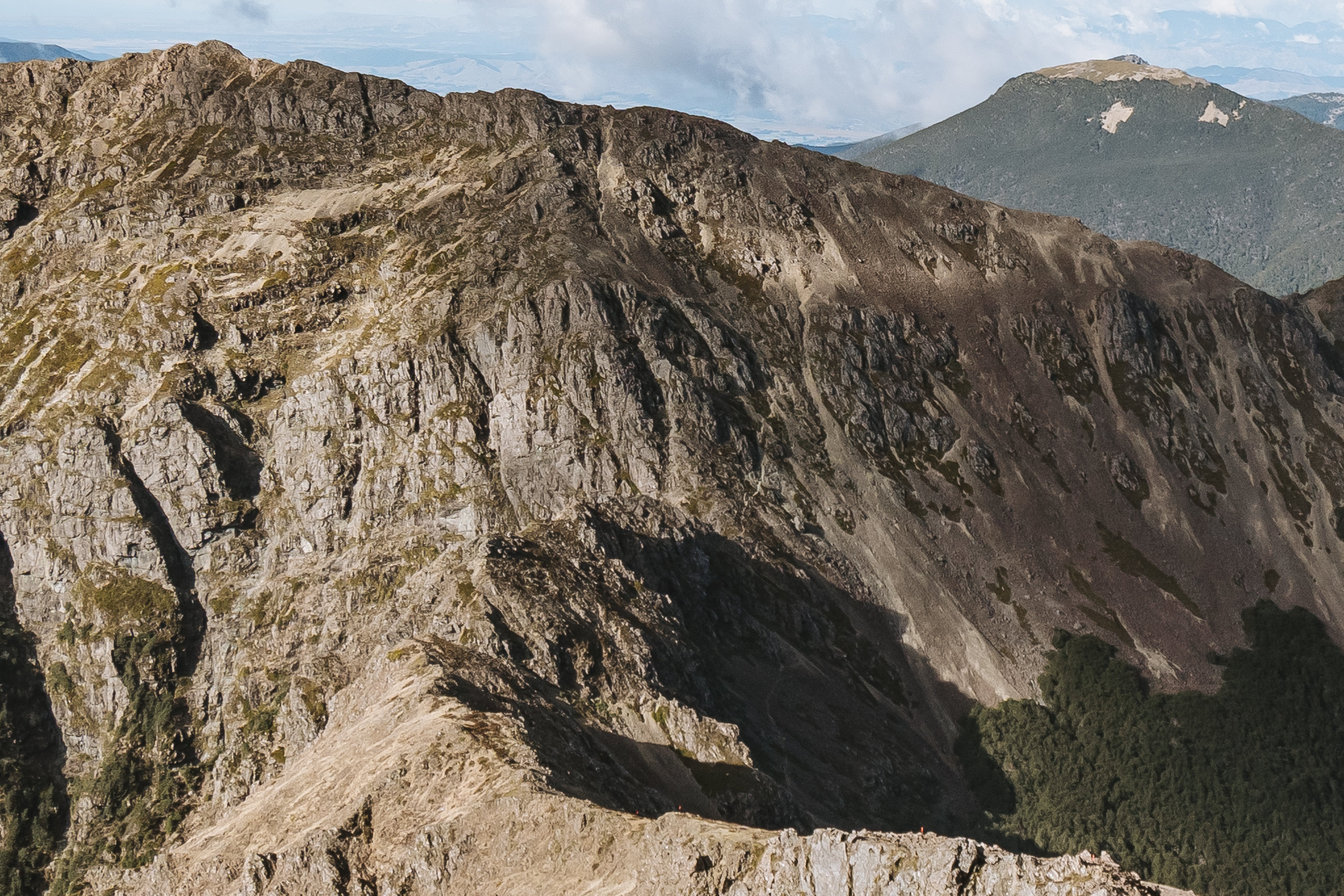
 Hey remember earlier when I told you about Old Man Hut was annoying to get to? Well look carefully from the top of Little Rintoul and you'll spot it waaaaaay down in a valley you're not even meant to go down.
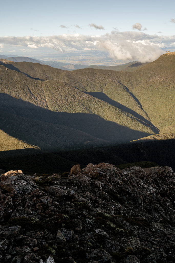
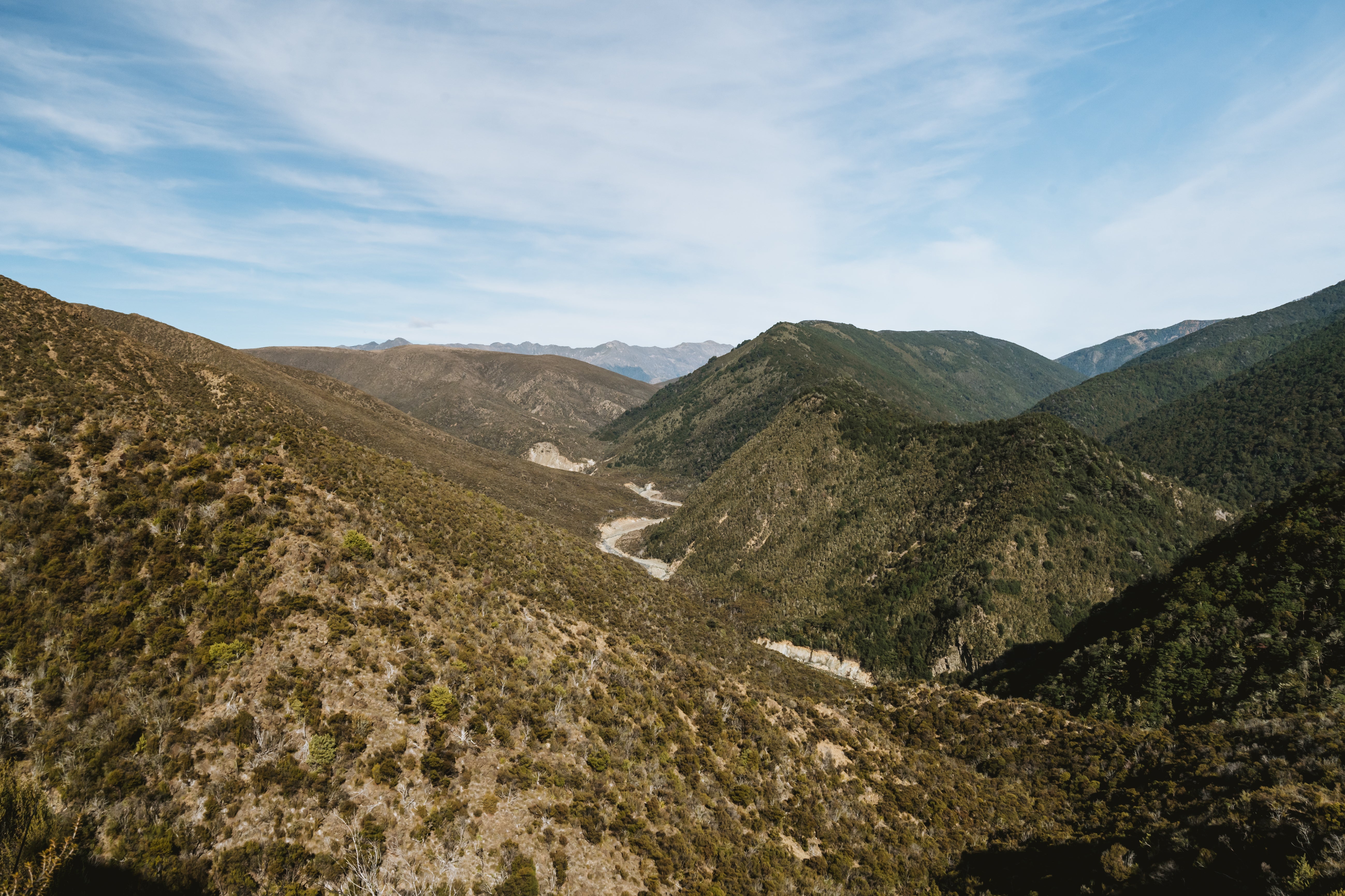
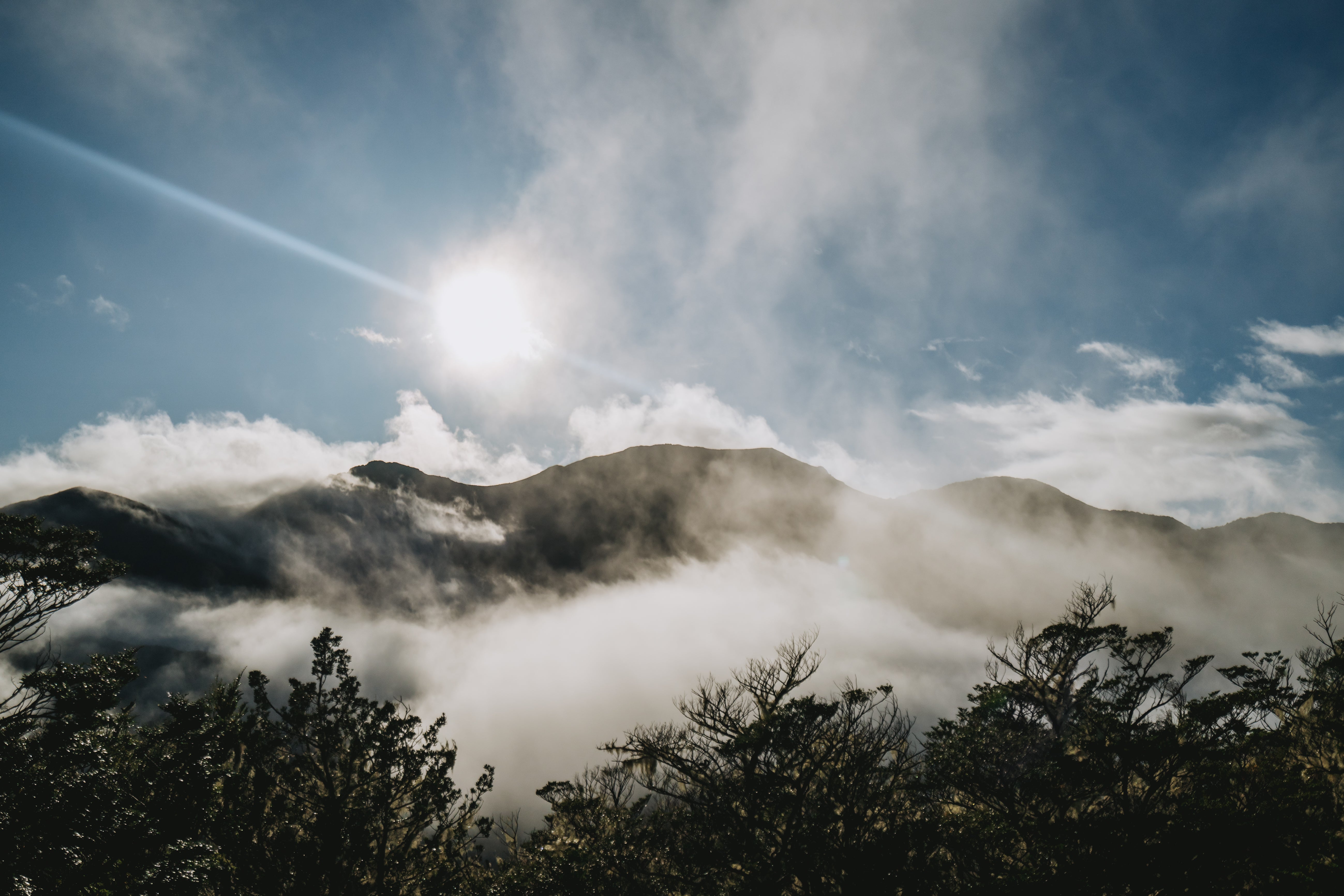
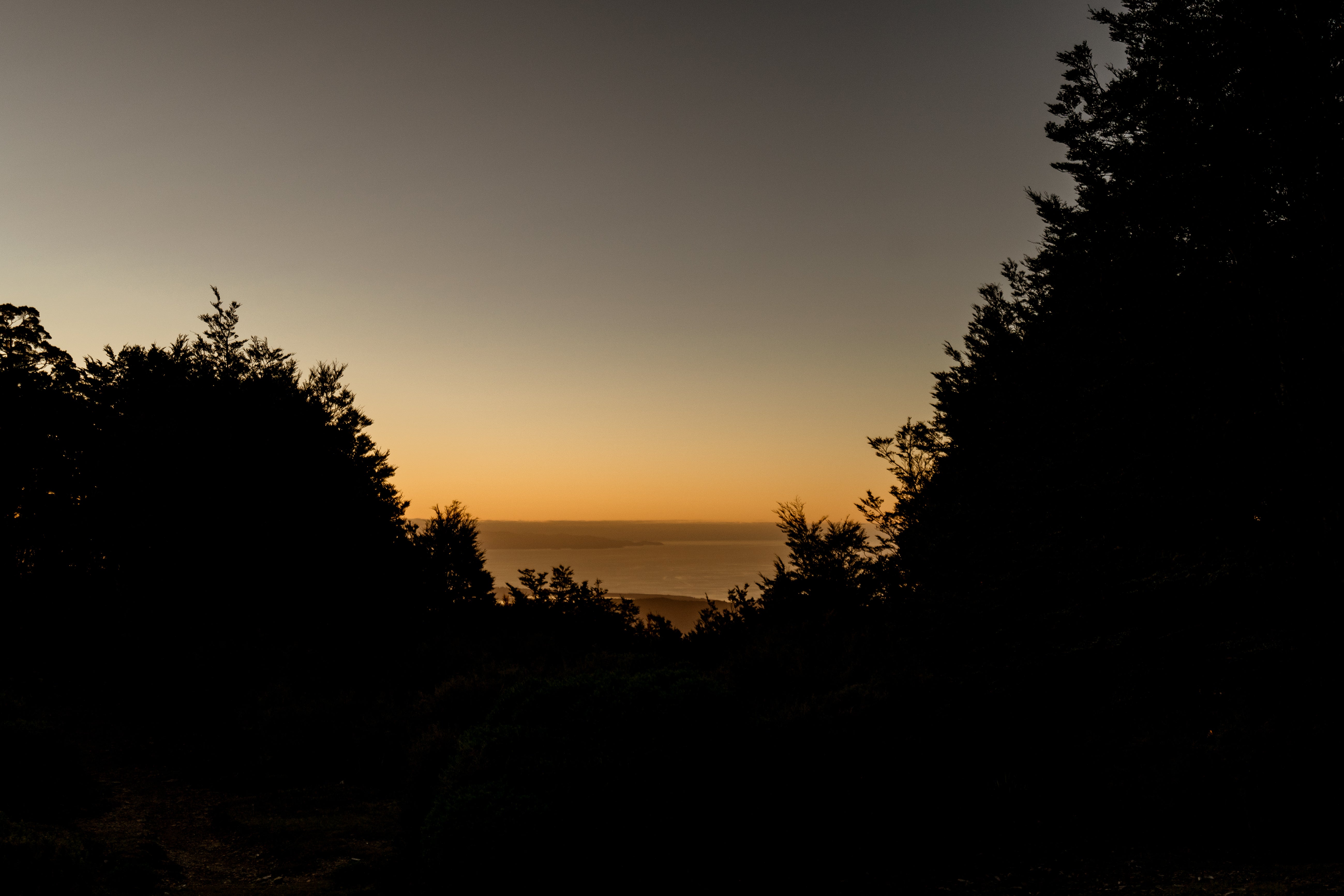
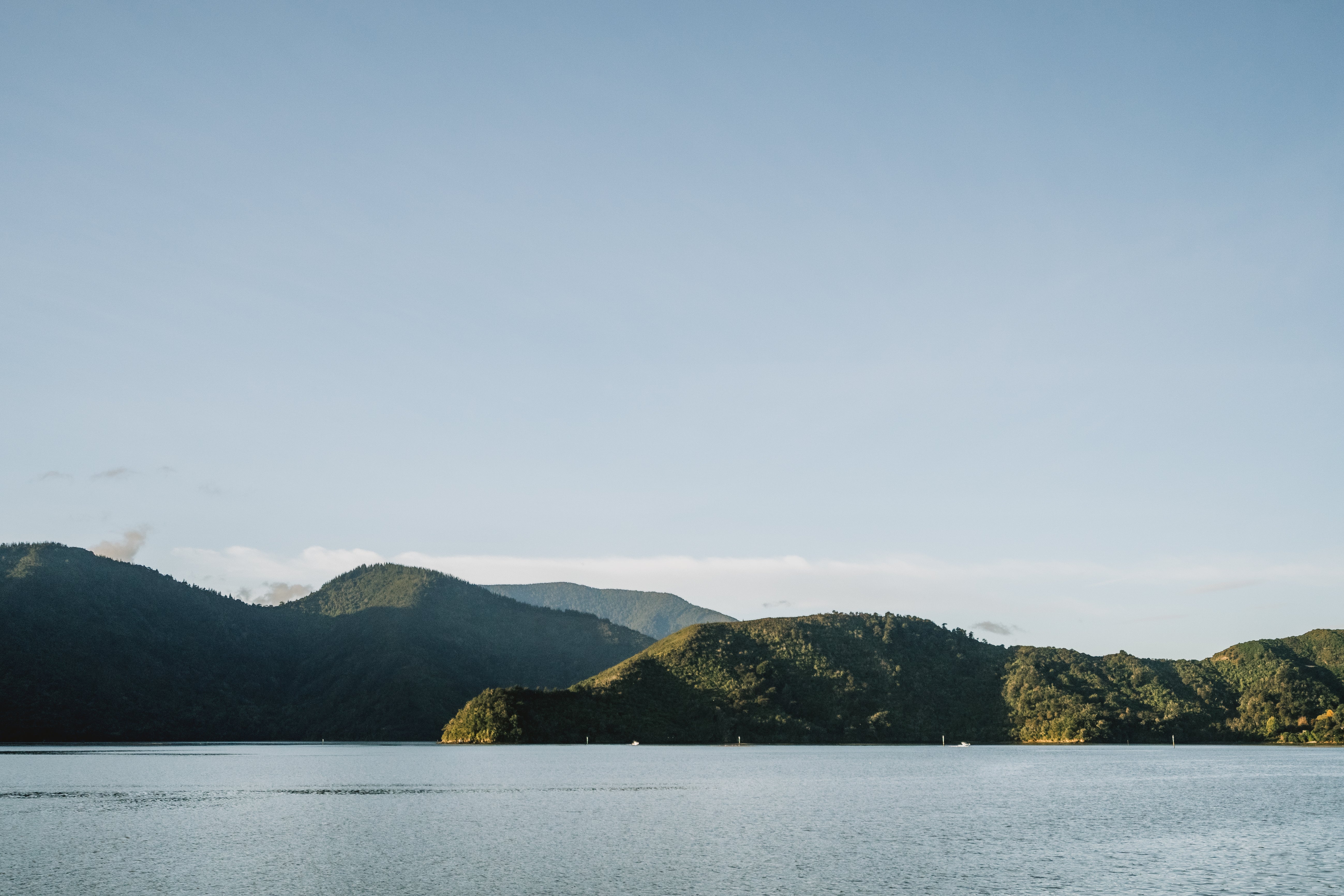
The ridge-lines continue to zigzag across the Richmond Range expanse, Old Man, Slaty Peak, and Mt Starveall all providing incredible trails and breathtaking views finishing at Starveall Hut for a jaw dropping sunset over Tasman Bay.
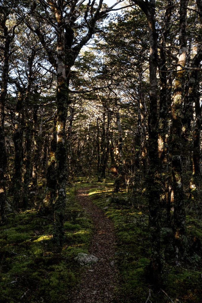


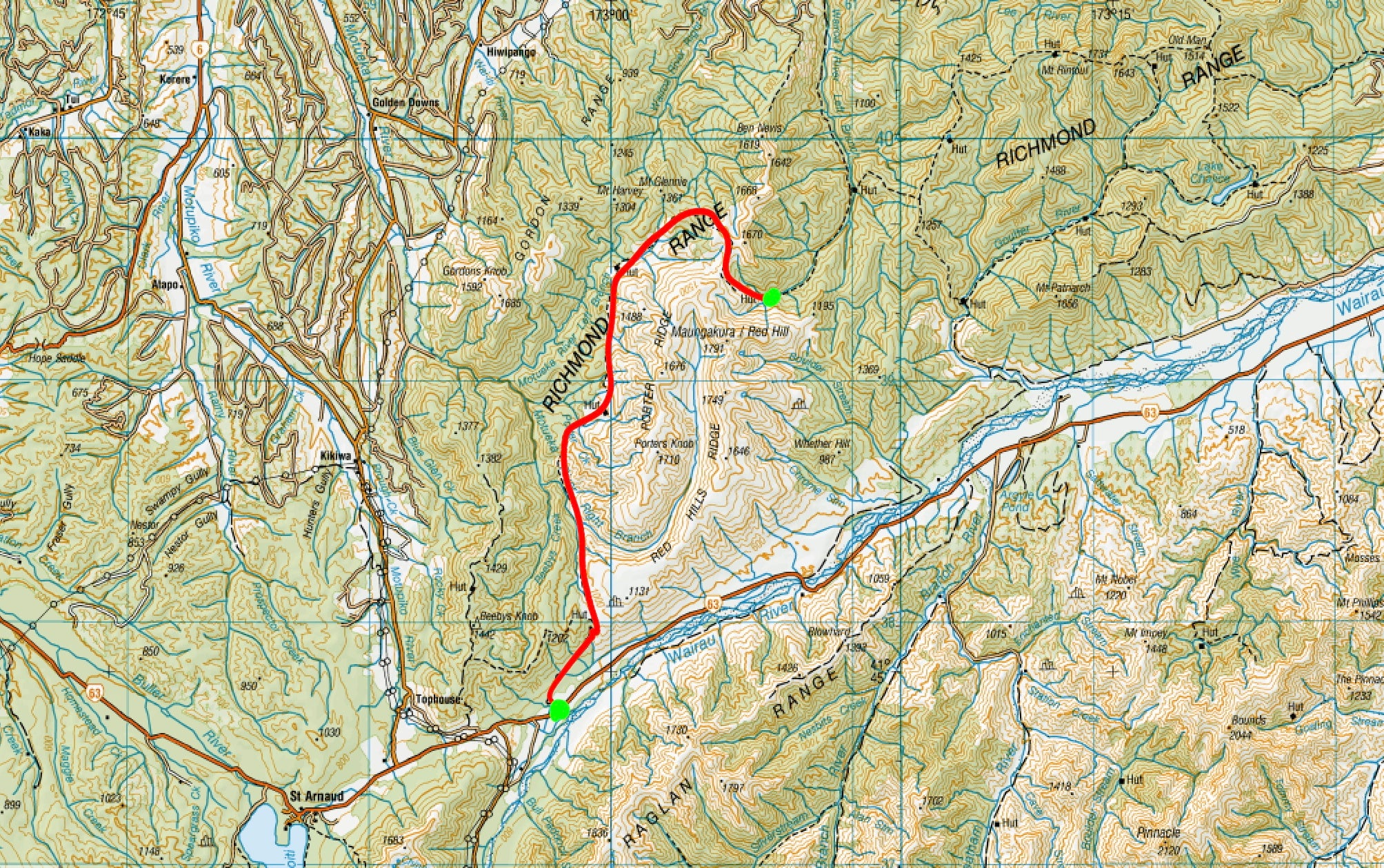
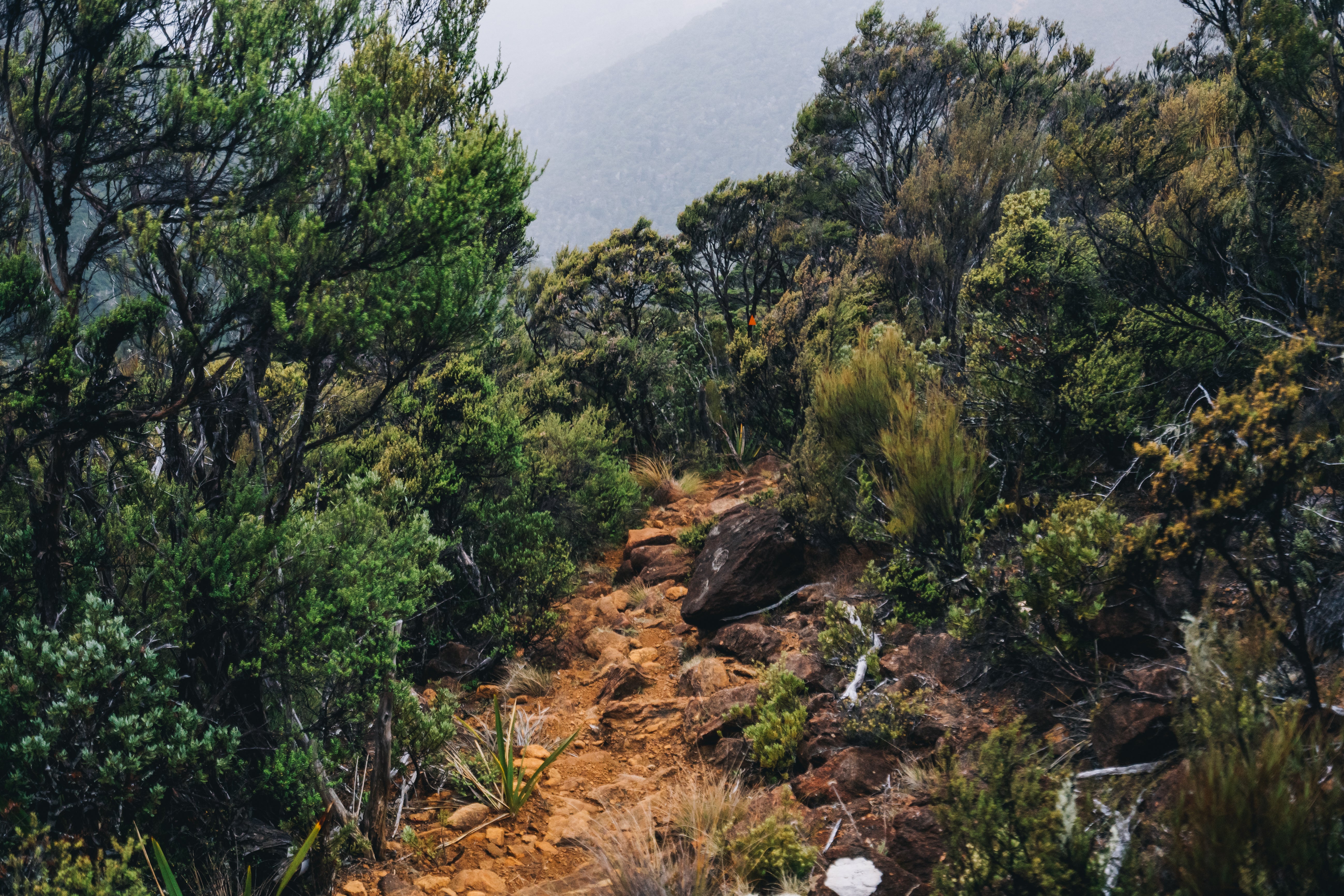
Beech Wandering
 Following the trail down from Starveall Hut leads you into 2-3 days of beech forest. You could easily finish here though as the road down to Nelson is pretty close, would only be a half day walk from Starveall but the track up to Pelorus river is worth the extra days and at this point your bag should be much lighter after you’ve eaten all your chocolate.

Eventually you arrive at Hackett hut and a few kms on is Browning Hut, they both look a bit like old school halls and I would hazard a guess that they are frequented by local schools considering how easy they are to reach from Nelson, so be wary of that I guess.


Between Browning Hut and Rocks hut is a pretty standard track, nothing too difficult except for the miles and miles of sopping wet ferns you need to bush bash through; you will be dripping wet by the end of it so it could be worth putting on your wet weather gear. Rocks hut is a serviced hut (with flushing toilets!!!) so you can get the fire pumping and dry your gear off after all those goddamn silver ferns.
 Heading down from there the bush is filled with Piwakawaka (fantails) so stir up the dirt as much as you can and give those lil cuties a good feed. Please enjoy my failed attempts at capturing their photos.


Whats annoying is that all these photos are pretty close to being great shots, but those god dam burds don't sit still...
...Anyway...

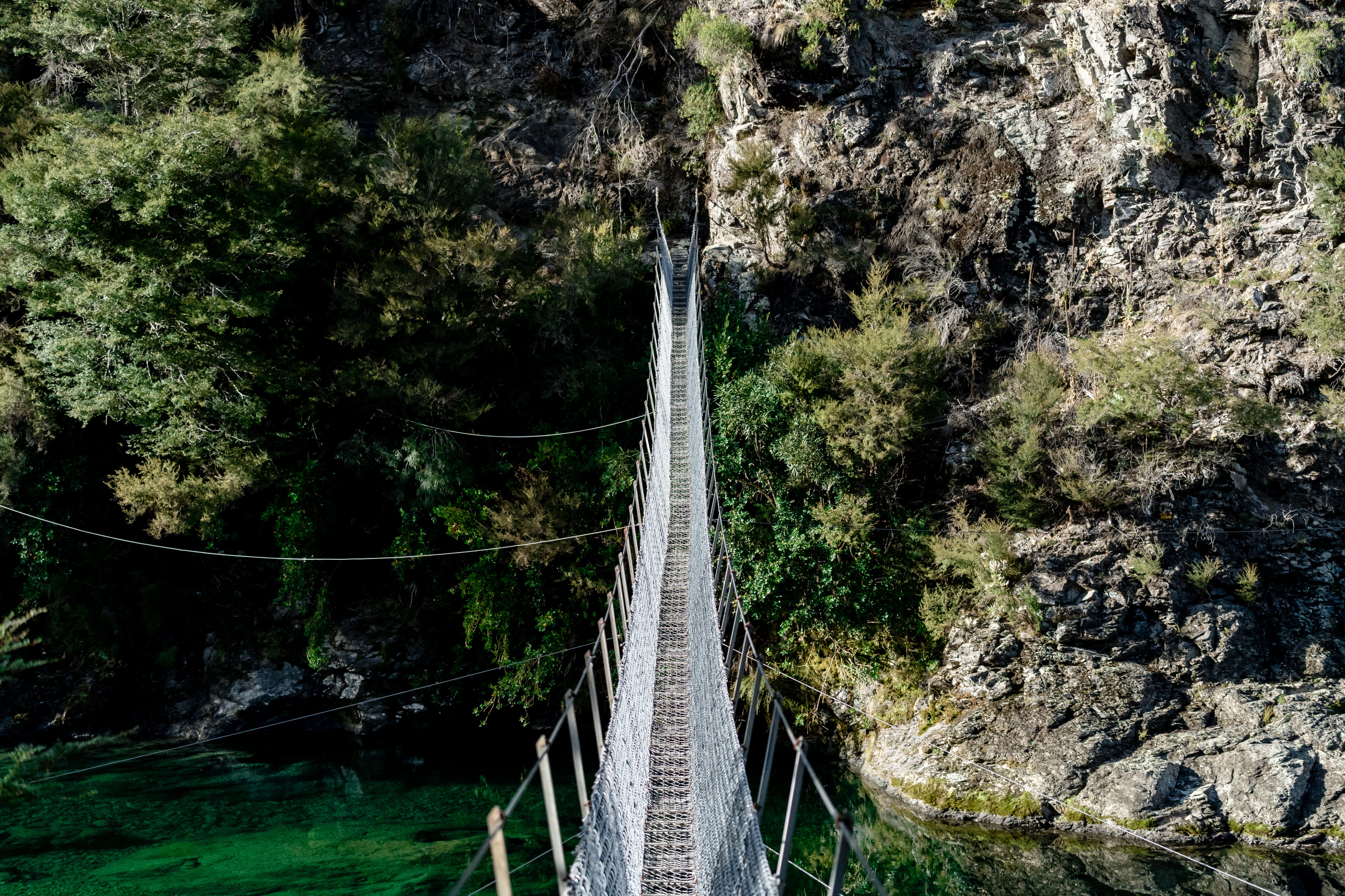
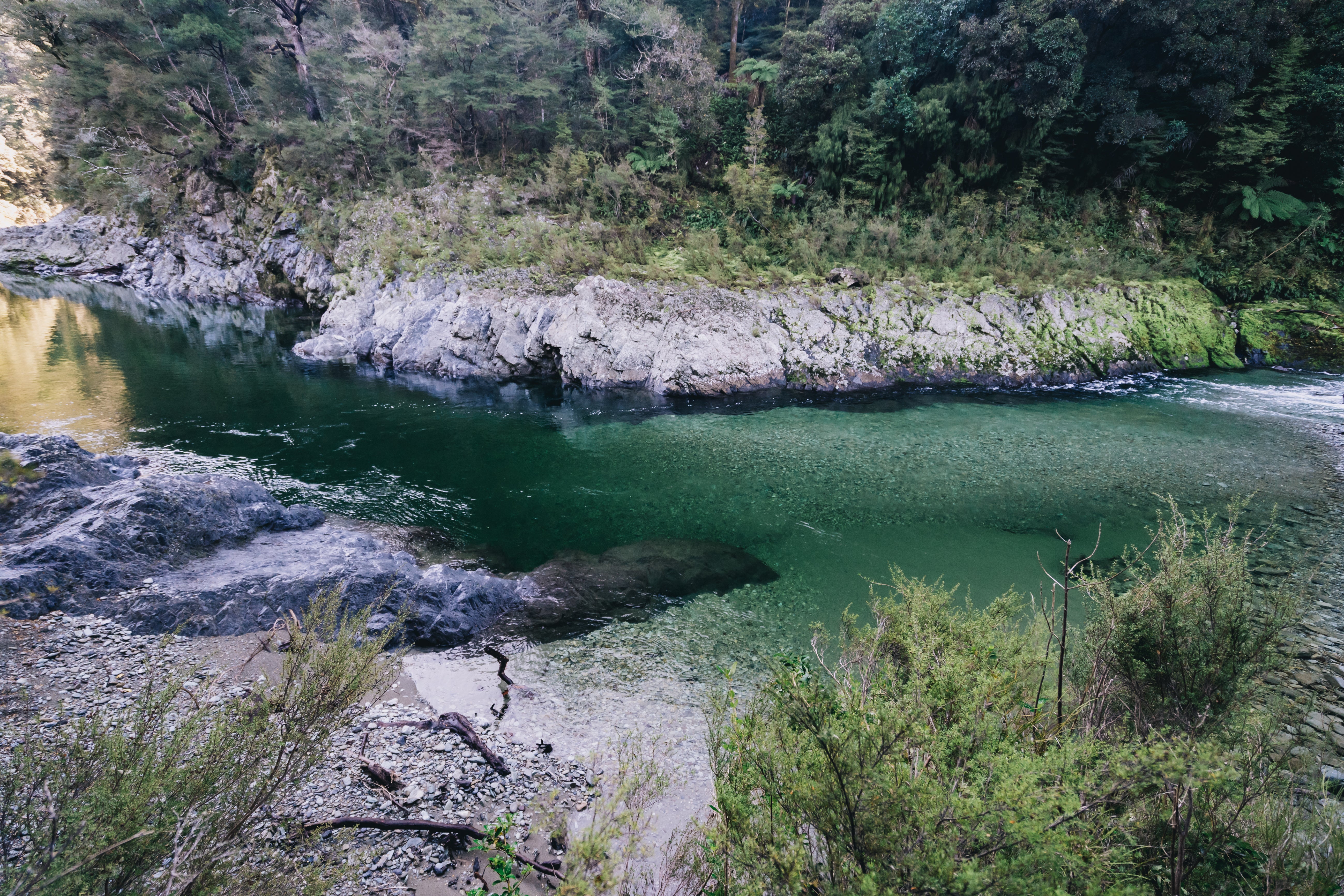
Eventually you’ll arrive at a swing bridge crossing the astoundingly emerald Te Hoiere/Pelorus River. An absolute sight to behold; Te Hoire is a stunning deep emerald colour and you get to follow this beauty all the way to the road end. Make sure you stop at the Emerald Pool for a quick sub-zero swim to wash off 7 days worth of dirt and stank before your Mum picks you up at the road end.


 It took me 7 days to complete this section but the sheer amount of huts on the track allows you to break it down to however many days you want, and with easy access to Nelson ⅔’s in you could be clever about how you pack for it too. You also don’t have to do it in one big sweep, the main roads are never too far away and there is almost always an exit route, (never an easy route though). Just make sure you carry one extra day more than you plan to be out for and you’ll be sweet.


Leave a comment